
The Best Hiking Trails in Vermont
Explore Hiking TrailsTop 38 hiking trails in Vermont
Page 1 of 2
1

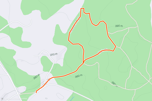
Wiessner Woods: Meadow Trail Loop
In the Wiessner Woods you’ll find a peaceful retreat in nature. It’s a protected forest with meadows, streams, and abundant wildlife. You may see birds, amphibians, deer, and maybe even a fox....
2


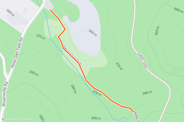
Moss Glen Falls
In the enchanting little gorge of Moss Glen Falls, you can stand in a light spray of cold mountain water, beneath overhanging ferns and a canopy of hemlock. The hike is short, but its strewn with rocks and roots and usually muddy....
3


Stowe Quiet Path
Stowe’s Recreation Path begins on Main Street in the Village and extends through fields and forest on a paved path. This trail is open to pedestrians as well as bicyclists. An alternative is the Stowe Quiet Path, which is for pedestrians only....
4
Mill Trail
5


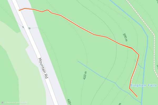
Bingham Falls
Bingham Falls is an easy and worthwhile hike in between the town of Stowe and Stowe Mountain Resort. It’s especially good on a warm summer day when you’ll enjoy the shade of the forest and the cold water of the creek....
6
Long Trail: Northern Terminus via Journeys End Trail
Completed in 1930, Vermont's 273-mile Long Trail boasts the title of the oldest long-distance hiking trail in the United States. Built and maintained by the Green Mountain Club, the trail dissects Vermont north to south, connecting the Massachusetts State line to the Canadian border....
7


Deer Leap Rock
Deer Leap Rock is the must-do short hike between Killington and Pico Mountain Resorts. The overlook offers views of both mountains and is a great spot to enjoy a snack with a view....
8
Blue Ridge Mountain via Canty Trail
The Canty Trail to Blue Ridge Mountain is a classic summit hike and the only route to this 3,250' peak towering over Mendon. The official summit offers epic views, though look for a side trail leading west to an even better overlook of Rutland! Making this hike even more fantastic, there's even a spur trail that leads to a large cascade about 1....
9
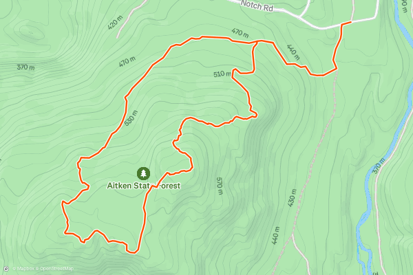
Bald Mountain Trail Loop
Just over 3 miles long, the Bald Mountain Trail offers the best mountaintop views near Rutland. Per the State Park's trail guide, this hike is "noted for its vistas, birdwatching potential, blueberries, and wildflowers," and "invites the visitor to explore all that Aitken State Forest has to offer....
10


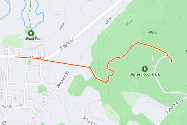
Sunset Rock
Sunset Rock is a forest park near the town center of Stowe. You can park at the shops and restaurants on Main Street, then walk into the woods and enjoy a leisurely stroll to a scenic view....
11


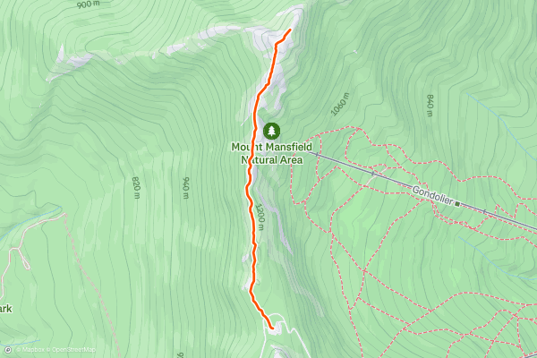
Mount Mansfield Summit from Auto Toll Road
Stowe, Vermont sits at the foot of the tallest mountain in the state–Mount Mansfield at 4,393 feet. On top of the mountain, the extreme climate creates a tundra-like landscape of stunted conifers and windswept rock....
12


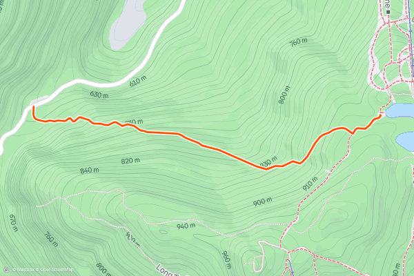
Sterling Pond Trail
Sterling Pond is one of the best moderate hikes at Smugglers Notch, and as such, it sees a lot of traffic. It’s a must-do if you are passing through the area in the summer, or if you spend some time at Stowe and want to check off the classic hikes....
13


Haselton Trail
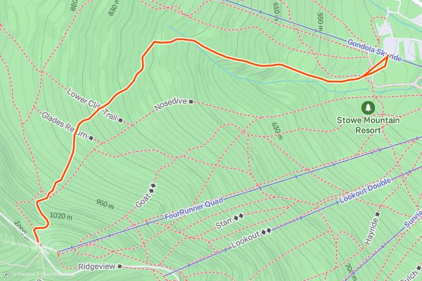
Haselton Trail is ideal for a casual summer or fall hike on Mount Mansfield. It begins near the base of the gondola at Stowe Mountain Resort. If you'd rather not ride the lift and exercise your legs instead, find this trailhead behind the Midway Lodge....
14


Appalachian Trail: MA-2 to Stratton Pond
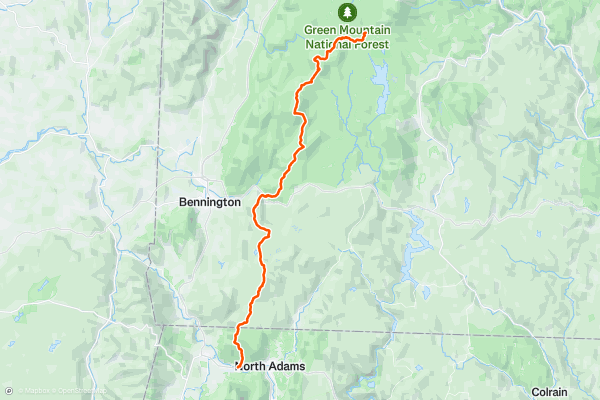
If heading north on the AT, take the time to properly re-supply in North Adams before heading north. Without hitchhiking, there are no notable resupply points along the way. Additionally, the Appalachian Trail Conservancy recommends avoiding this region in April and May due to mud....
15


Appalachian Trail: Stratton Pond to Big Branch
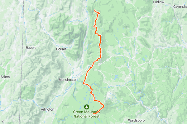
Begin this segment of the Appalachian Trail at the Stratton Pond Parking area along Stratton Arlington Road, accessed from VT-100. Should the parking area be full, a few other opportunities lie east on the road....
16


Appalachian Trail: Big Branch to US-4
To begin this segment, take Brooklyn Road east from US-7. As the road winds into the mountains, pass a picnic area and overlook before reaching the trailhead.
To the south, the Appalachian Trail enters Big Branch Wilderness....
17


Appalachian Trail: US-4 to Hanover
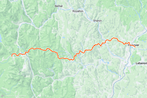
This segment of the Appalachian Trail begins along US-4 at the AT/LT Parking area. Many thru-hikers take advantage of this trailhead to access the town of Rutland for resupply.
Head north to begin the segment, and keep right at the junction with the Catamount Trail to continue to the next intersection where the Appalachian Trail and Long Trail part ways....
18


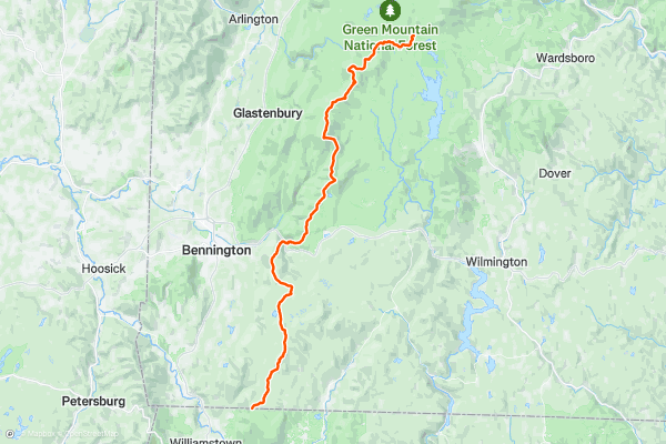
Long Trail: Massachusetts State Line to Stratton Pond
Completed in 1930, Vermont's 273-mile Long Trail boasts the title of the oldest long-distance hiking trail in the United States. Built and maintained by the Green Mountain Club, the trail dissects Vermont north to south, connecting the Massachusetts State line to the Canadian border....
19
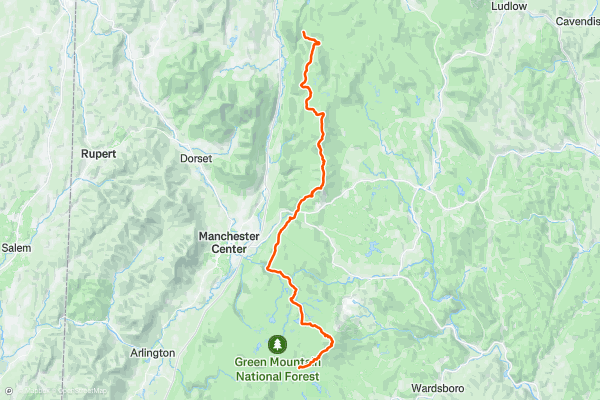
Long Trail: Stratton Pond to Big Branch
Begin this segment of the Long Trail at the Stratton Pond Parking area along Stratton Arlington Road, accessed from VT-100. Should the parking area be full, a few other opportunities lie east on the road....
20
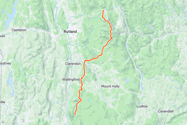
Long Trail: Big Branch to US-4
To begin this segment, take Brooklyn Road east from US-7. As the road winds into the mountains, pass a picnic area and overlook before reaching the trailhead.
To the south, the Long Trail enters the Big Branch Wilderness....
Page 1 of 2
Top regions for hiking trails on Strava
- Acadia National Park
- Alabama
- Alaska
- Albuquerque
- Alyeska
- Angeles National Forest
- Arizona
- Arkansas
- Austin, TX
- Bay Area
- Bend
- Big Sky
- Blue Mountain Ski Area
- Boston
- Boulder, CO
- Brevard
- Bridger Bowl
- Buena Vista
- California
- Cape Cod
- Colorado
- Connecticut
- Dahlonega
- Downieville
- Ellijay
- Flagstaff
- Florida
- Georgia
- Glacier National Park (USA)
- Grand Teton National Park
- Great Smoky Mountains National Park, TN
- Hawaii
- Hurricane
- Hyalite
- Idaho
- Illinois
- Indiana
- Kansas
- Kentucky
- Lake Tahoe
- Las Vegas, NV
- Los Angeles, CA
- Maine
- Mammoth Mountain
- Marin County
- Maryland
- Massachusetts
- Maui, HI
- Michigan
- Minnesota
- Missouri
- Moab
- Montana
- Mount Rainier National Park
- Mt. Rainier National Park, WA
- Nederland
- Nevada
- New Hampshire
- New Jersey
- New Mexico
- New York
- New York, NY
- North Bridgers
- North Carolina
- North Dakota
- Oakridge
- Ohio
- Oklahoma
- Oregon
- Park City and Deer Valley
- Pennsylvania
- Phoenix, AZ
- Placitas
- Portland, OR
- Roanoke
- Salida
- Salt Lake City, UT
- San Diego, CA
- San Francisco, CA
- Santa Fe, NM
- Santa Monica Mountains
- Seattle, WA
- Sedona, AZ
- Sisters
- South Carolina
- South Dakota
- South Lake Tahoe, CA
- Stowe
- Sugarbush
- Sun Valley
- Taos
- Telluride
- Tennessee
- Texas
- Timberline Lodge Summer
- Utah
- Vermont
- Virginia
- Washington
- West Virginia
- Wind River Range
- Winter Park
- Wisconsin
- Wyoming
- Yellowstone National Park
- Yosemite National Park, CA
- Zion National Park, UT