
Les meilleurs Chemins de randonnée à Oakridge
Explorer les Chemins de randonnée8 meilleurs chemins de randonnée à Oakridge
1


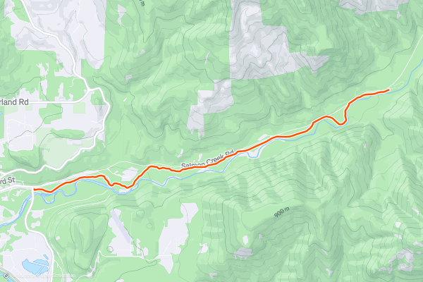
Salmon Creek Out-and-Back
While most of the trails in Oakridge are steep and demanding, this diverse destination does offer a nice relaxing hike: the Salmon Creek Trail.
Salmon Creek can be combined with a few other trails in the area, but for the most laid back hike, simply complete an out-and-back from the trailhead marked here....
2


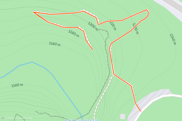
Salt Creek Falls
Salt Creek Falls plunges 286 vertical feet off of a sheer cliff into a beautiful canyon far below. This impressive natural formation is the third tallest waterfall in the state of Oregon....
3


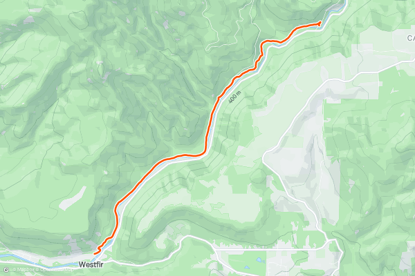
North Fork
The North Fork Trail runs along the banks of North Fork of the Willamette River through a narrow river valley. You'll enjoy stunning river views along the entire length of this route!
The trail starts off easy and smooth from the trailhead, but after about 3 miles it gets quite a bit rougher, more technical, and more challenge....
4


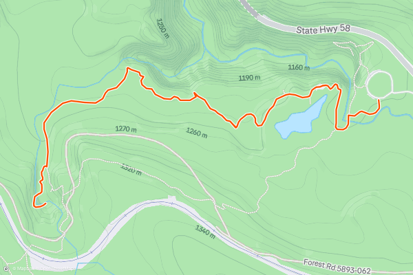
Diamond Creek Falls
This stunning hike to Diamond Creek Falls provides a lovely selection of the very best that the Cascades has to offer.
The route begins by meandering beneath a towering canopy of Douglas Fir trees on pine needle-covered trails....
5


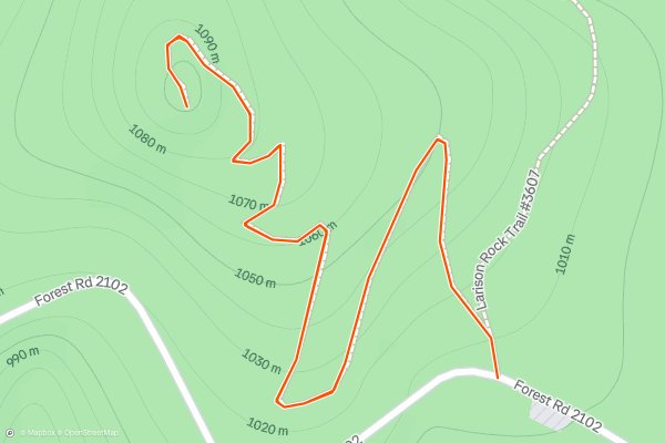
Larison Rock Short Hike
While most of the approaches to Oakridge's most epic viewpoints require many miles of hiking, Larison Rock offers the opportunity for a short one-mile jaunt to a scenic view over the region....
6


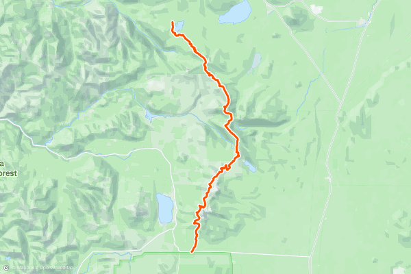
PCT: Highway 138 to Summit Lake
The north boundary of Crater Lake National Park marks the northern end of Oregon Section C, and the beginning of Section D on the Pacific Crest Trail. This section traces a lofty reach of the Cascade Crest, alongside eminent peaks like Thielsen and Diamond....
7
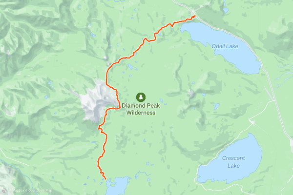
PCT: Summit Lake to Highway 58
Summit Lake, located at the end of the previous segment, makes a popular and beautiful place to spend the night along the PCT. From a vantage on the lake’s south shore, Diamond Peak crowns the horizon proudly....
8


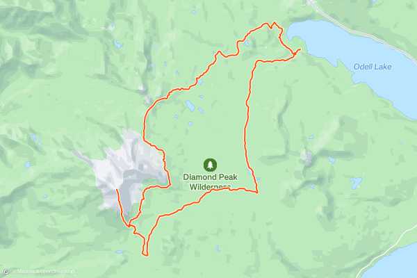
Diamond Peak Loop
Start at the Trapper Creek Trailhead, and follow the trail 0.2 mile to the first junction. Keep left at the fork for a gradual ascent through open forest, paralleling Trapper Creek, which cascades over rocks and down trees, creating mini waterfalls along the way....
Meilleures régions pour les chemins de randonnée sur Strava
- Acadia National Park
- Alabama
- Alaska
- Albuquerque
- Alyeska
- Angeles National Forest
- Arizona
- Arkansas
- Austin, TX
- Bay Area
- Bend
- Big Sky
- Blue Mountain Ski Area
- Boston
- Boulder, CO
- Brevard
- Bridger Bowl
- Buena Vista
- California
- Cape Cod
- Colorado
- Connecticut
- Dahlonega
- Downieville
- Ellijay
- Flagstaff
- Florida
- Georgia
- Glacier National Park (USA)
- Grand Teton National Park
- Great Smoky Mountains National Park, TN
- Hawaii
- Hurricane
- Hyalite
- Idaho
- Illinois
- Indiana
- Kansas
- Kentucky
- Lake Tahoe
- Las Vegas, NV
- Los Angeles, CA
- Maine
- Mammoth Mountain
- Marin County
- Maryland
- Massachusetts
- Maui, HI
- Michigan
- Minnesota
- Missouri
- Moab
- Montana
- Mount Rainier National Park
- Mt. Rainier National Park, WA
- Nederland
- Nevada
- New Hampshire
- New Jersey
- New Mexico
- New York
- New York, NY
- North Bridgers
- North Carolina
- North Dakota
- Oakridge
- Ohio
- Oklahoma
- Oregon
- Park City and Deer Valley
- Pennsylvania
- Phoenix, AZ
- Placitas
- Portland, OR
- Roanoke
- Salida
- Salt Lake City, UT
- San Diego, CA
- San Francisco, CA
- Santa Fe, NM
- Santa Monica Mountains
- Seattle, WA
- Sedona, AZ
- Sisters
- South Carolina
- South Dakota
- South Lake Tahoe, CA
- Stowe
- Sugarbush
- Sun Valley
- Taos
- Telluride
- Tennessee
- Texas
- Timberline Lodge Summer
- Utah
- Vermont
- Virginia
- Washington
- West Virginia
- Wind River Range
- Winter Park
- Wisconsin
- Wyoming
- Yellowstone National Park
- Yosemite National Park, CA
- Zion National Park, UT