
Bendで一番のハイキングトレイル
ハイキングトレイルを探索Bendにおける上位17件のハイキングトレイル
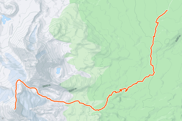
1


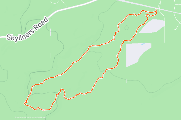
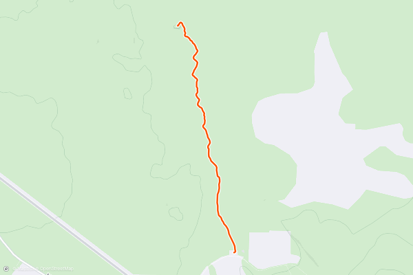
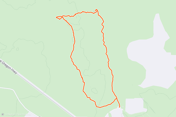
Kent's -> Phil's Short Loop
Kent’s to Phil’s is an iconic loop that anchors the famous Phil’s Trail Network.
To begin this mellow hike, head up the Kent’s trail from the primary Phil’s Trailhead. Kent’s is an easy climbing trail that is still technically open for downhill traffic....
2


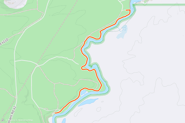
Deschutes River Trail
The Deschutes River Trail in its entirety stretches over 13 miles one-way along the banks of the river. This multi-use trail can easily be broken into shorter segments for a delightful, easy ride, hike, or run....
3


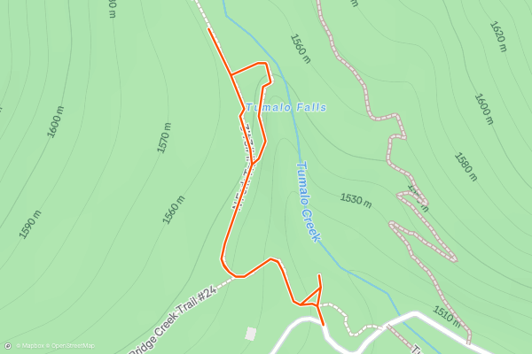
Tumalo Falls Viewpoints
Tumalo Falls ranks among the most popular sightseeing stops near Bend, Oregon. Here, Tumalo Creek flies off a precipice, dropping 97 feet straight down to thunder on the rocks in the bottom of a canyon far, far below....
4


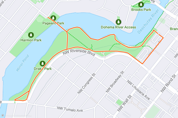
Mirror Pond
In many ways, Mirror Pond forms the epicenter of the city of Bend. The still, glassy water is created by a small dam across the Deschutes River. Ducks flock to this still pond, and paddleboarders take to it in droves during the summer....
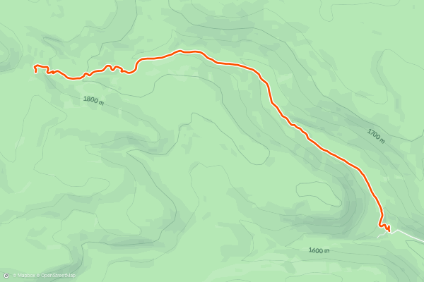
5
Badlands Rock
Badlands Rock is a large outcropping of volcanic rock surrounded by the Oregon Badlands Wilderness. From the top, you'll enjoy 360-degree views of this remote desert landscape, as well as long-range views of the Cascade volcanoes in the distance....
6


Badlands Rock -> Flatiron Rock Loop
The Oregon Badlands Wilderness is a flat desert landscape punctuated by large upthrust formations of volcanic rock. This loop visits two of the most popular rock formations: Badlands Rock and Flatiron Rock....
7


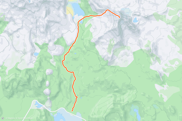
Green Lakes
Green Lakes is renowned as one of the most popular and most rewarding hikes of moderate difficulty near Bend, Oregon. While the total distance is just over 9 miles round-trip, the trail is relatively smooth and only gains 1,250 feet of elevation....
8

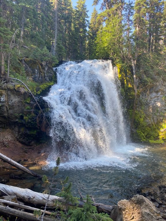

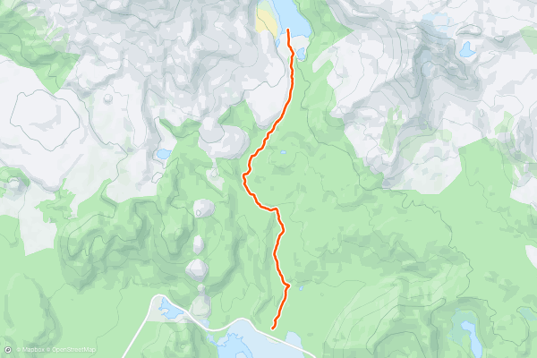
Tumalo Falls and North Fork
Tumalo Falls ranks among the most popular sightseeing stops near Bend, Oregon. Here, Tumalo Creek flies off a precipice, dropping 97 feet straight down to thunder on the rocks in the bottom of a canyon far, far below....
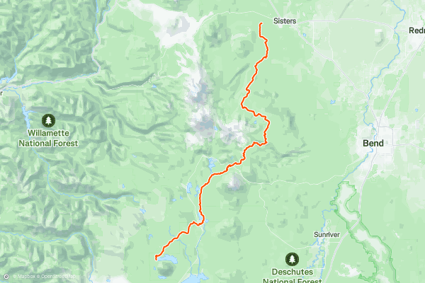
9


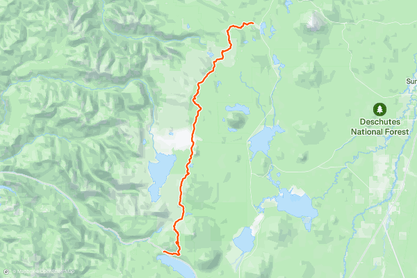
PCT: Highway 58 to Elk Lake junction
This begins Section E of the Pacific Crest Trail in Oregon, proceeding northward into the Three Sisters Wilderness. The furrowed landscape, shaped both by volcanoes and glaciers over time, is cloaked in deep forest and dotted with little lakes....
10


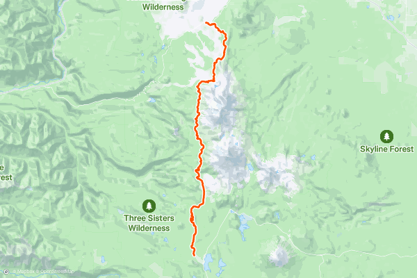
PCT: Elk Lake junction to McKenzie Pass
To finish up Oregon Section E, the PCT proceeds northward through the Three Sisters Wilderness, passing the namesake trio of dormant volcanoes. The South, Middle, and North Sisters each rise thousands of feet, with South Sister as the tallest....
11


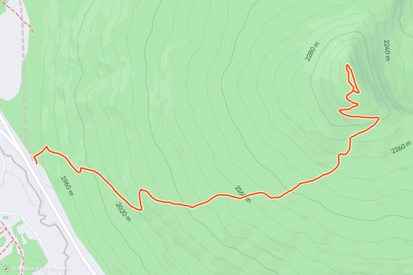
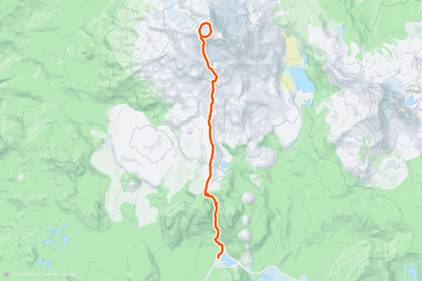
Tumalo Mountain
7,779-foot Tumalo Mountain isn’t in and of itself a significant climb, but the 360-degree views of volcanic peaks and rolling tree-covered mountain ridges are well-worth the effort!
Begin the hike from the trailhead on the Cascade Lakes Highway—don’t forget your Northwest Forest Pass....
12


Metolius-Windigo Trail
This long-distance hiking trail traverses the wild mountains west of Bend, Oregon. Dipping in and out of several different wilderness areas, the trail extends from the town of Sisters to Cultus Lake....
13


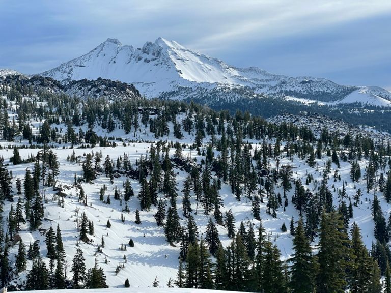

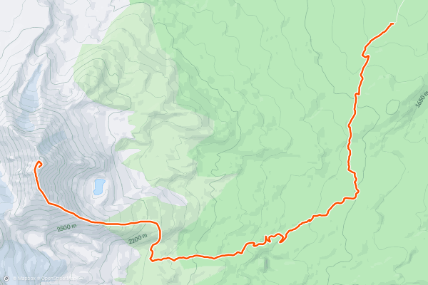
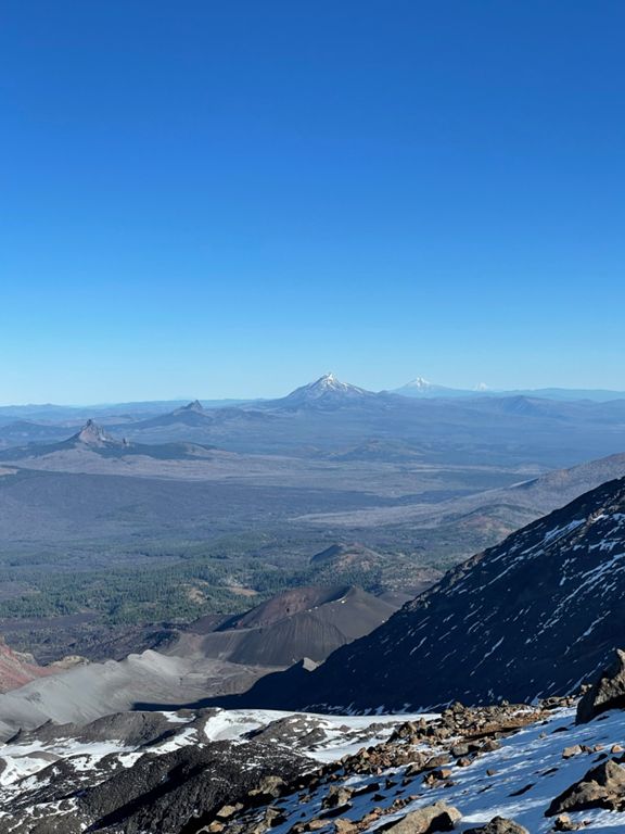
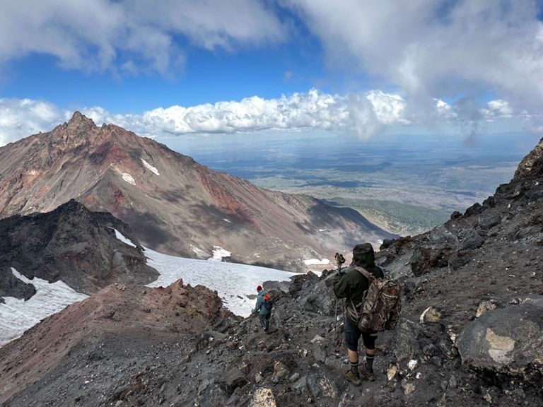
South Sister
The Three Sisters formation of volcanoes dominates the skyline of the Cascade Mountains as they march up the spine of Oregon, just to the west of Bend. The tallest of the three is 10,358-foot South Sister, and consequently, it is a popular hiking, trail running, and mountaineering objective....
14


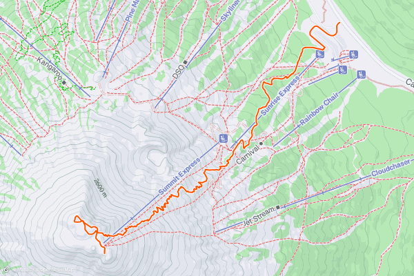
Mount Bachelor
While Mount Bachelor is best known for its skiing, the lofty volcanic summit makes for an attractive peak climbing objective in the summertime. If you follow the standard Sunrise to Summit Trail, you’ll enjoy a non-technical hike on a switchbacked singletrack trail all the way to the summit of 9,065-foot Mount Bachelor
Begin the hike off the side of the Cascades Lake Highway near Sunrise Lodge....
15

Broken Top: Northwest Ridge via Green Lakes Trail
*Note: this route gets a "Moderate" Mountaineering difficulty rating.*
Broken Top is a volcanic mountain in the Three Sisters Wilderness. It sits in the shadow of the Three Sisters themselves, not as tall but still impressive with it’s craggy slopes and jagged summit....
16


North Sister
*Note: this route warrants a "Moderate" Mountaineering difficulty rating.*
The North Sister is the most difficult of the Three Sisters to climb. While South Sister is the tallest, North Sister is the most technical, with some class 4 scrambling required on poor rock and loose dirt....
17


Middle Sister
Middle Sister is the shortest of the Three Sisters at 10,046 feet, but it's still a more technical climb than South Sister, the tallest of the three.
The route mapped here approaches via the Pole Creek Trail and Camp Lake Trail....
Stravaにおけるハイキングトレイルの人気地域
- Acadia National Park
- Alabama
- Alaska
- Albuquerque
- Alyeska
- Angeles National Forest
- Arizona
- Arkansas
- Austin, TX
- Bay Area
- Bend
- Big Sky
- Blue Mountain Ski Area
- Boston
- Boulder, CO
- Brevard
- Bridger Bowl
- Buena Vista
- California
- Cape Cod
- Colorado
- Connecticut
- Dahlonega
- Downieville
- Ellijay
- Flagstaff
- Florida
- Georgia
- Glacier National Park (USA)
- Grand Teton National Park
- Great Smoky Mountains National Park, TN
- Hawaii
- Hurricane
- Hyalite
- Idaho
- Illinois
- Indiana
- Kansas
- Kentucky
- Lake Tahoe
- Las Vegas, NV
- Los Angeles, CA
- Maine
- Mammoth Mountain
- Marin County
- Maryland
- Massachusetts
- Maui, HI
- Michigan
- Minnesota
- Missouri
- Moab
- Montana
- Mount Rainier National Park
- Mt. Rainier National Park, WA
- Nederland
- Nevada
- New Hampshire
- New Jersey
- New Mexico
- New York
- New York, NY
- North Bridgers
- North Carolina
- North Dakota
- Oakridge
- Ohio
- Oklahoma
- Oregon
- Park City and Deer Valley
- Pennsylvania
- Phoenix, AZ
- Placitas
- Portland, OR
- Roanoke
- Salida
- Salt Lake City, UT
- San Diego, CA
- San Francisco, CA
- Santa Fe, NM
- Santa Monica Mountains
- Seattle, WA
- Sedona, AZ
- Sisters
- South Carolina
- South Dakota
- South Lake Tahoe, CA
- Stowe
- Sugarbush
- Sun Valley
- Taos
- Telluride
- Tennessee
- Texas
- Timberline Lodge Summer
- Utah
- Vermont
- Virginia
- Washington
- West Virginia
- Wind River Range
- Winter Park
- Wisconsin
- Wyoming
- Yellowstone National Park
- Yosemite National Park, CA
- Zion National Park, UT