
Nevadaで一番のハイキングトレイル
ハイキングトレイルを探索Nevadaにおける上位38件のハイキングトレイル
Page 1 of 2
1


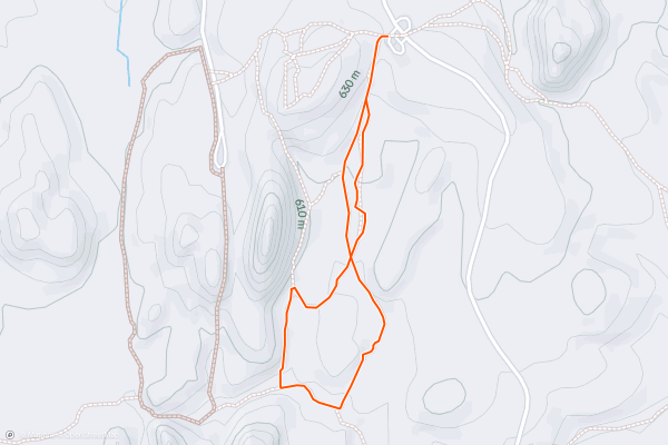
Calico Tanks Trail
The Calico Tanks Trail is a unique hike that takes you through beautiful sandstone rock formations in Red Rock Canyon National Conservation Area. As you make your way, you’ll come to a number of natural rock pools, known as “tanks,” which are filled when there’s been enough rain. This hike follows an out and back route. It is on the shorter side, but requires a good amount of scrambling and maneuvering over rocks. Despite the short length, most hikers consider this a hard trail. This is one of the most popular and photo worthy hikes in the area. During some portions of the year, access to the canyon requires a timed ticket. Check here to see you’ll need one <a href="https://www.recreation.gov/timed-entry/10075177">https://www.recreation.gov/timed-entry/10075177</a>
2


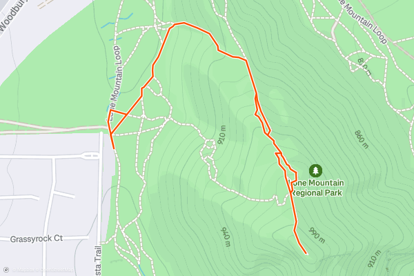
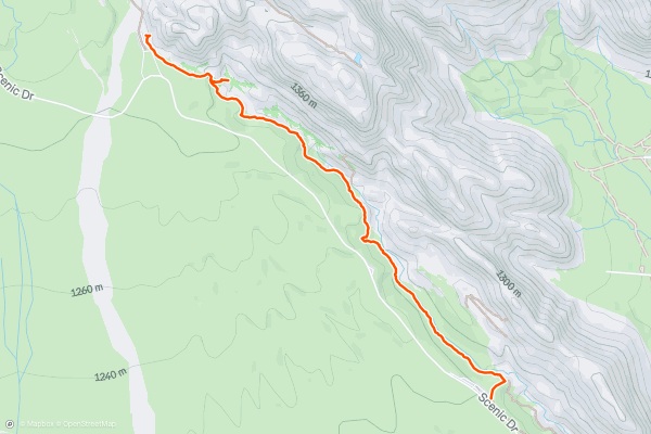
Lone Mountain Trail
The Lone Mountain Trail is a short, but steep and rewarding hike in Las Vegas. At the top you’ll enjoy views of the city to the east and Red Rock Canyon to the west. The trail follows an out and back route. It’s on the shorter side, but because of the sustained steep grade, most hikers consider this a hard route. This is one of the most popular hikes with Strava members in Las Vegas. The summit is a great place to enjoy a snack and some great views.
3


Mustang Loop
This short 4-mile loop provides the perfect hiking outing in the Las Vegas desert without any of the challenges of the more difficult trails. The singletrack here is smooth and almost entirely bereft of rocks and technical obstacles, allowing hikers to soak in the views of the dramatic red rock cliffs in the distance....
4


McCullough Hills Loop
The McCullough Hills trail system provides a fantastic escape from the suburban sprawl of Las Vegas, yet it is accessible directly from one of those same suburban neighborhoods. Here you'll find a well-developed trailhead, complete with bathrooms, located in a neighborhood on the outskirts of Henderson....
5


Badger Pass Loop
If you're looking for a mellow hike that will quickly reward you with beautiful desert views, head for the Badger Pass trail.
The hike begins from the popular Late Night Trailhead and heads under the highway and up a low pass toward the larger hills to the west of Vegas....
6


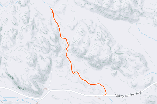
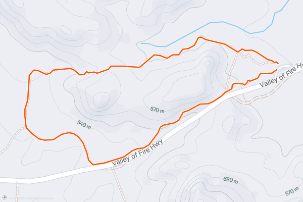
Fire Wave Trail
The Fire Wave trail is far and away the most famous hike in Valley of Fire State Park, thanks to a mellow trail leading to a spectacular rock formation.
The hike begins by following a sandy track that slowly winds its way down from the trailhead....
7


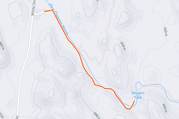
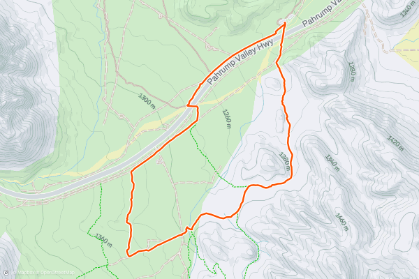
Petroglyph Canyon via Mouse's Tank Trail
If you are looking for a short and easy hike that offers a glimpse into the ancient history and culture of the Native Americans who inhabited this area, then the Mouse's Tank Trail to Petroglyph Canyon is a great option....
8


Rainbow Vista Trail to Fire Canyon Overlook
Prepare to be dazzled by the Rainbow Vista Trail to Fire Canyon Overlook, a hike that takes you through a kaleidoscope of sandstone colors and shapes in Valley of Fire State Park....
9
Natural Arches Trail
If you are looking for a hike that takes you into a hidden world of colorful sandstone canyons, arches, and balancing rocks, then the Natural Arches Trail in Valley of Fire State Park is a great option....
10


Ice Box Canyon Trail
The Ice Box Canyon Trail is a fun hike through a shady, secluded canyon in the Red Rock Canyon National Conservation Area. Depending on the time of year, there may even be water flowing and some small waterfalls to check out! The trail follows an out and back route. Much of the trail is moderate, but because of a few technical and steep sections most hikers consider this a hard trail. This is one one of the most popular hikes in the area with Strava members. During some portions of the year, access to the canyon requires a timed ticket. Check here to see you’ll need one <a href="https://www.recreation.gov/timed-entry/10075177">https://www.recreation.gov/timed-entry/10075177</a>
11


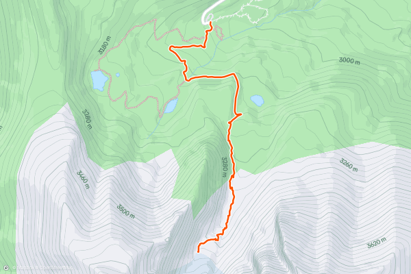
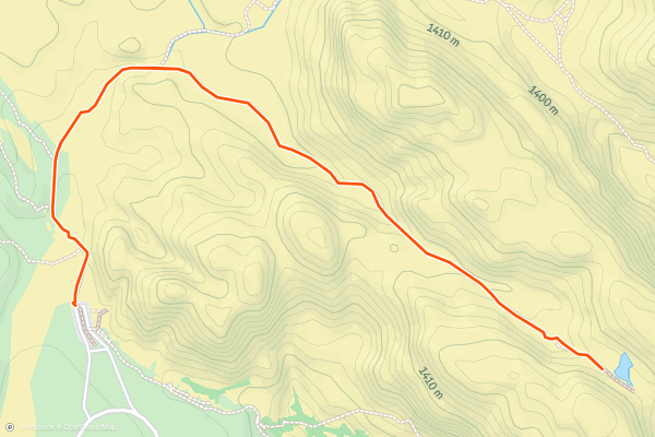
Bristlecone and Glacier Trail
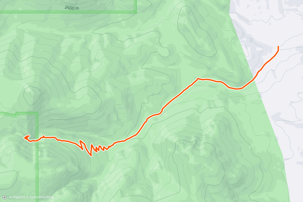
Great Basin National Park is well known for bristlecone pine trees, which are some of the oldest living organisms on the planet. They subsist in rocky alpine soils, expanding minutely in each short growing season, but enduring for thousands of years....
12


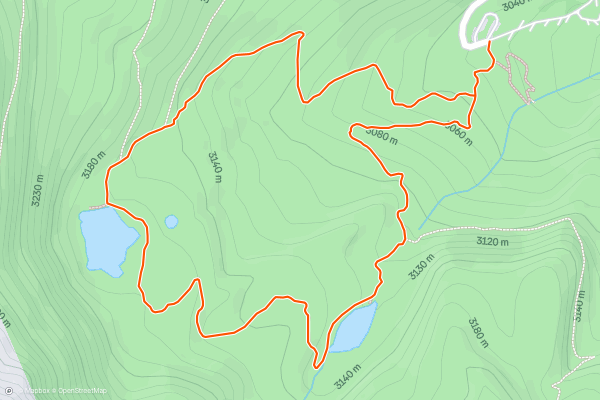
Alpine Lakes Loop
This is one of the park’s most popular hikes, providing a concise tour of the subalpine environment on Wheeler Peak. On this loop, you’ll hike through a forest of bristlecone pines to reach tranquil views at two alpine lakes, Stella and Teresa....
13


Calico Hills
The Calico Hills are a unique formation of deep red sandstone slabs that soar into the sky, dominating the viewscape as you enter the Red Rock Canyon Conservation Area. The popular Calico Tanks hike winds around the backside of the first ridge and leads straight into the heart of the hills, but the hike shown here traverses along the front side of the rock formation....
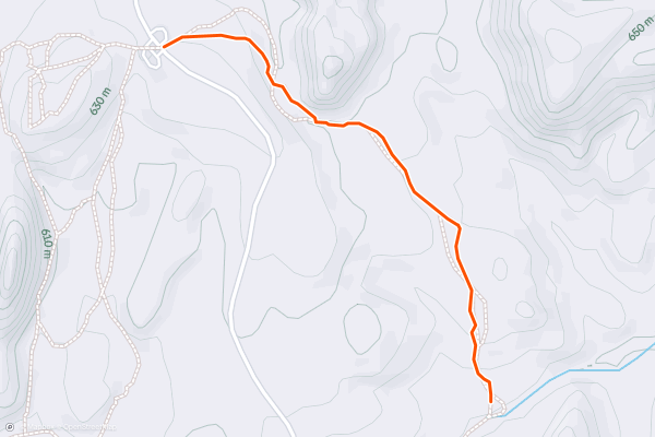
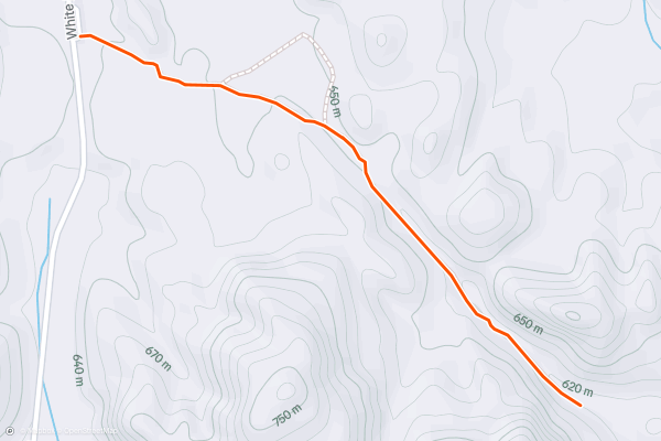
14


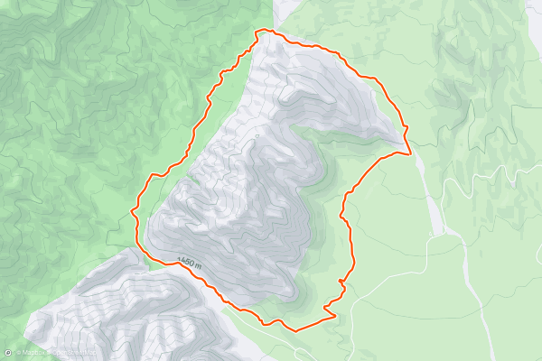
White Rock Loop
The White Rock Loop runs for 6.2 miles, circumnavigating the prominent peak by the same name. This loop gets quite remote and goes well away from the crowds as it swings around the backside of the mountain, and yet with less than 1,200 feet of elevation gain, it's still a highly achievable route....
15
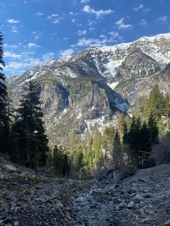


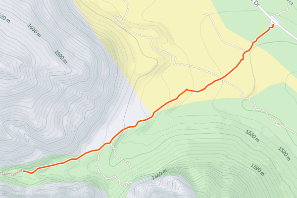
Mary Jane Falls
Mary Jane Falls is a popular hiking destination in the Mount Charleston area. For Las Vegas city dwellers, Mount Charleston provides a welcome relief from the summer heat. The mountain peak soars to almost 12,000 feet above sea level with a staggering 8,259 feet of vertical relief, meaning that even the hikes lower down the mountain flanks, like Mary Jane Falls, are still many thousands of feet above the blistering desert valley that Las Vegas rests in....
16


Seven Wonders Loop
The Seven Wonders trail is one of the most spectacular short hikes in Valley of Fire State Park. The route shown here is a logical loop on the Seven Wonders trail, including a few of the connected alt trails....
17
Elephant Rock Loop
Elephant Rock is one of the most visited rock formations in Valley of Fire State Park, as it is located directly adjacent to one of the main entrance stations. Many visitors pay their entry fee and promptly pull into the parking lot to check out this visually stunning arch resembling an elephant....
18


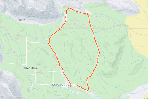
Calico Basin Loop
Located just a short drive from the Las Vegas Strip, Calico Basin is part of the Red Rock Canyon National Conservation Area, renowned for its striking sandstone formations, colorful cliffs, and unique desert flora and fauna....
19


Turtlehead Peak Trail
The Turtlehead Peak Trail is a challenging and rewarding hike to the summit of Turtlehead Mountain in the La Madre Mountain Wilderness. The trail follows an out and back route. This hike has several steep sections and a large amount of overall elevation gain. Most hikers consider this a hard hike, and the views from the summit are a worthy reward. The Turtlehead peak trail is a popular hike with Strava members. Check out the photos from the community to get a sense of what you’ll see along the trail.
20
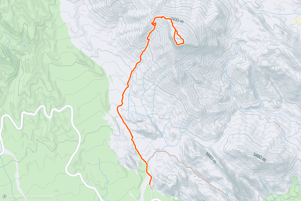
Lexington Arch
This giant natural arch protruding from a mountainside lies deep in the backcountry of Great Basin National Park and is not reached via any park entrance gate. It’s found by driving a remote 4WD road, then hiking a rugged trail....
Page 1 of 2
Stravaにおけるハイキングトレイルの人気地域
- Acadia National Park
- Alabama
- Alaska
- Albuquerque
- Alyeska
- Angeles National Forest
- Arizona
- Arkansas
- Austin, TX
- Bay Area
- Bend
- Big Sky
- Blue Mountain Ski Area
- Boston
- Boulder, CO
- Brevard
- Bridger Bowl
- Buena Vista
- California
- Cape Cod
- Colorado
- Connecticut
- Dahlonega
- Downieville
- Ellijay
- Flagstaff
- Florida
- Georgia
- Glacier National Park (USA)
- Grand Teton National Park
- Great Smoky Mountains National Park, TN
- Hawaii
- Hurricane
- Hyalite
- Idaho
- Illinois
- Indiana
- Kansas
- Kentucky
- Lake Tahoe
- Las Vegas, NV
- Los Angeles, CA
- Maine
- Mammoth Mountain
- Marin County
- Maryland
- Massachusetts
- Maui, HI
- Michigan
- Minnesota
- Missouri
- Moab
- Montana
- Mount Rainier National Park
- Mt. Rainier National Park, WA
- Nederland
- Nevada
- New Hampshire
- New Jersey
- New Mexico
- New York
- New York, NY
- North Bridgers
- North Carolina
- North Dakota
- Oakridge
- Ohio
- Oklahoma
- Oregon
- Park City and Deer Valley
- Pennsylvania
- Phoenix, AZ
- Placitas
- Portland, OR
- Roanoke
- Salida
- Salt Lake City, UT
- San Diego, CA
- San Francisco, CA
- Santa Fe, NM
- Santa Monica Mountains
- Seattle, WA
- Sedona, AZ
- Sisters
- South Carolina
- South Dakota
- South Lake Tahoe, CA
- Stowe
- Sugarbush
- Sun Valley
- Taos
- Telluride
- Tennessee
- Texas
- Timberline Lodge Summer
- Utah
- Vermont
- Virginia
- Washington
- West Virginia
- Wind River Range
- Winter Park
- Wisconsin
- Wyoming
- Yellowstone National Park
- Yosemite National Park, CA
- Zion National Park, UT