
Colorado 中最佳的 远足路径
探索 远足路径Colorado 中 远足路径 的前 318 名
Page 1 of 16
1


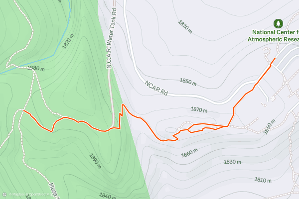
Mallory Cave via N.C.A.R. Trail
The Mallory Cave hike takes you to the mouth of a beautiful cave that’s home to a population of Townsend’s Big-Eared Bats. The cave is closed to protect the bats and us humans, but you can still trek to the entrance and peer in. The hike follows an out and back route along the N.C.A.R. Trail. The trail is on the shorter side and doesn’t feature too much elevation gain. Most consider this an easy hike. The Mallory Cave hike is one of the most popular with local Strava members.
2


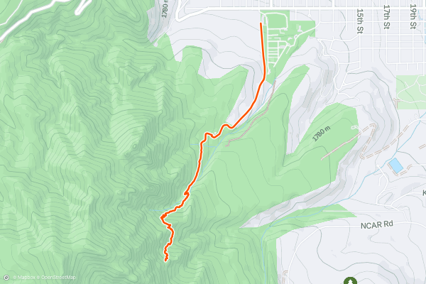
Royal Arch
The Royal Arch hike is Boulder at its best. You’ll trek to a natural stone arch with views of the city, the famous Flatirons, and the valley to the east. The trail follows an out and back route. There are consistently steep grades throughout, so most consider this a hard hike. This hike is one of the most popular in the area with local Strava members and visitors from out of town. Take a look at the photos from the community to get a sense of what you’ll see along the way.
3


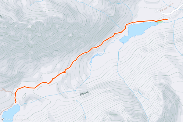
Crater Lake
Crater is located just under 2 miles from the Maroon Lake parking lot in the Maroon Bells-Snowmass Wilderness. The lake was formed as glaciers in the valley retreated and left flat, open spaces where water collected in a process known as glacial benching....
4


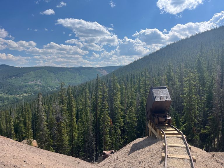


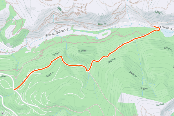
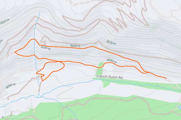
Sallie Barber Mine Trail
This is an easy hike at the edge of Breckenridge, where residential areas transition into wild mountains. The trailhead is along French Gulch road a few miles east of town, and the route leads west along the forested north-facing slope of this valley below Bald Mountain....
5


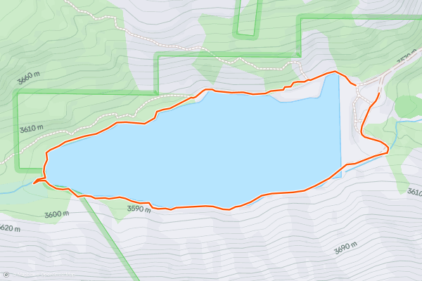
Blue Lakes Trail
An easy trail just south of Breckenridge, Blue Lakes is a great place to enjoy Colorado’s mountain scenery and wildlife with very little work. A dirt road leads along Monte Cristo Creek to nearly 12,000 feet elevation, above treeline, where wild mountain goats are common, and where two alpine lakes shimmer in blue beneath white-capped peaks....
6


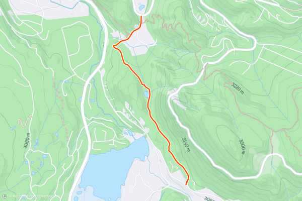
Indiana Gulch
This is a dirt path in the woods that travels in between Boreas Pass Road and Indiana Creek Road in Breckenridge. It passes behind some private homes along Indiana Creek, but the middle portion of the trail is in a miniature valley tucked out of sight, which is surprisingly quiet despite its proximity to the road....
7


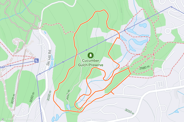
Cucumber Gulch Trails
Cucumber Gulch is a tiny wildlife preserved tucked in between the ski resort and the town of Breckenridge. For its size, it packs a surprising diversity of wildlife. You may see beaver, fox, deer, elk, moose, and many bird species in the forests, meadows, and ponds here....
8


Minnie Mine Loop
This is an easy loop with French Gulch Road that connects Reiling Dredge and B&B trailheads, and passes old mine ruins. Beginning from Reiling Dredge, the trail to Minnie Mine cuts west and upward on an old dirt road cut into the hillside....
9


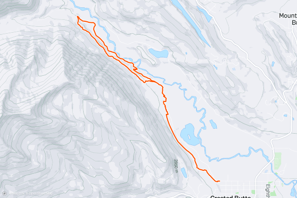
Lower Loop
Hanging out in Crested Butte and hankering for a hike? Thanks to the convenient access to the Lower Loop trail, you can hike directly from idyllic downtown Crested Butte directly onto beautiful, mostly flat singletrack....
10


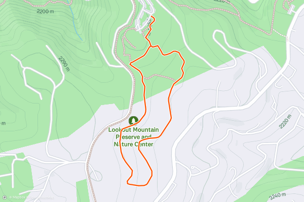
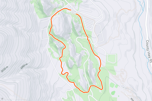
Forest and Meadow Loop
This is a simple, family-friendly hike located right next to the nature center on Lookout Mountain. Stop in the center to learn about regional plants and wildlife, then walk this trail for a chance to spot some of them....
11


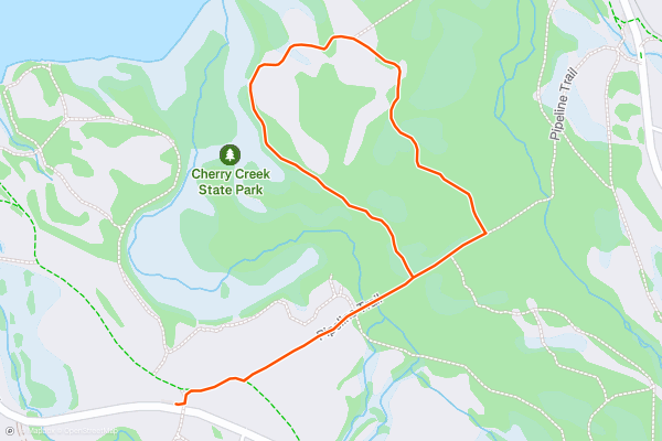
Cherry Creek Wetland Loop
Cherry Creek State Park is an oasis of water and nature near downtown Denver. The lake, hiking trails, campground and abundance of other activities here are popular among locals and visitors alike....
12


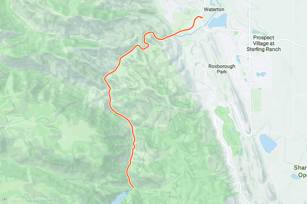
Waterton Canyon
The South Platte River tumbles out of the Rocky Mountains in a deep gorge where trees grow thick and bighorn sheep roam. The canyon feels wild, even though it’s quite close to the urban area, and the scenery is an interesting juxtaposition of nature and infrastructure....
13


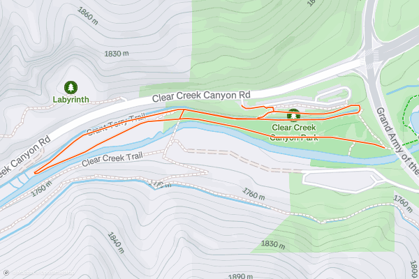
Grant Terry Trail
When Denver heats up in the summer, everyone seeks the water to cool off. Luckily, the mountains to the west provide a constant supply of cold runoff. Clear Creek is one of the waterways that flow year-round with refreshing snowmelt from the Rockies....
14


Trading Post Trail at Red Rocks
Red Rocks is the world-renowned Amphitheater formed by natural cliffs near Denver. Huge fins of red sandstone protrude near the base of Mount Morrison. Their shape and size just happens to be perfect for acoustics, so the amphitheater was built....
15


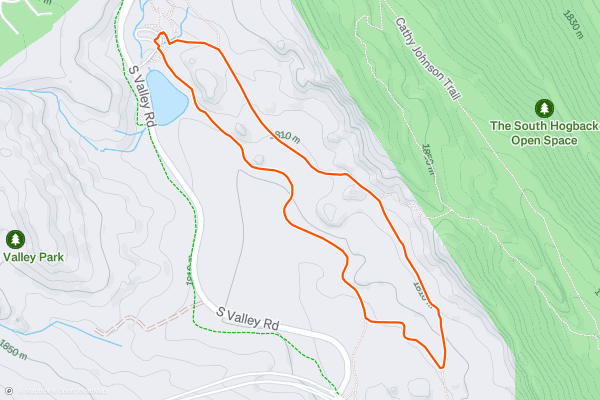
Coyote Song and Swallow Trail Loop
South Valley is a natural getaway hidden in plain sight near Littleton. It’s tucked behind the Hogback, an elongate hill west of town. Within the valley are gently rolling meadows punctuated by large stone spires and fins....
16


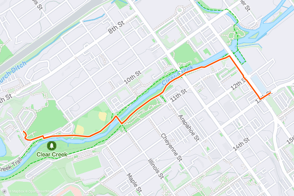
Clear Creek Greenway to Coors Brewery
Clear Creek is a waterway that drains the Rocky Mountains, running year round with crisp snowmelt from peaks along the Continental Divide. It flows through Golden, Colorado then to its confluence with the South Platte River in downtown Denver....
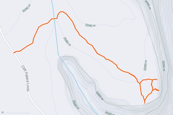
17
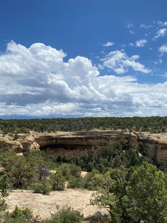


Cliff Palace
Cliff Palace is one of the most beautiful and most elaborate of the cliff dwellings found in Mesa Verde National Park. While you can quickly walk from the road to the edge of the canyon wall to view it from a distance, you can only descend to the Palace and enter some of the dwellings on a ranger-guided tour....
18


Knife Edge
The Knife Edge trail is a flat, easy hike that traverses along a sharp escarpment, providing stunning views of the Montezuma Valley laid out below you. In the distance, you'll spot Sleeping Ute Mountain....
19


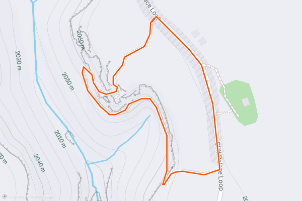
Soda Canyon Overlook
This short hike leads to three different vantage points over various aspects of Soda Canyon. The southernmost overlook provides a vantage of the Balcony House cliff dwellings, and the center overlook is the eponymous "Soda Canyon Overlook....
20


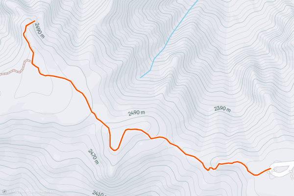
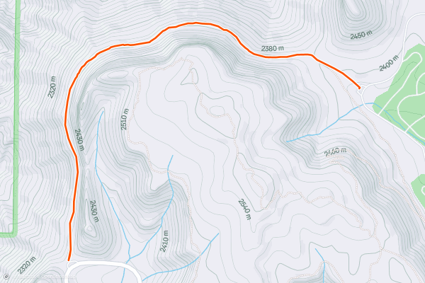
Warner Point
This short 1.5-mile round-trip hike leads to some of the most beautiful views of the Black Canyon of the Gunnison! The trail "skirts the south rim to Warner Point, which bears one of the widest views of the canyon, extending to the Painted Wall to the east and along the Gunnison’s gradual descent to the plateau to the west," writes Jonathan Stull on [OutdoorProject....
Page 1 of 16
Strava 上 远足路径 的热门区域
- Acadia National Park
- Alabama
- Alaska
- Albuquerque
- Alyeska
- Angeles National Forest
- Arizona
- Arkansas
- Austin, TX
- Bay Area
- Bend
- Big Sky
- Blue Mountain Ski Area
- Boston
- Boulder, CO
- Brevard
- Bridger Bowl
- Buena Vista
- California
- Cape Cod
- Colorado
- Connecticut
- Dahlonega
- Downieville
- Ellijay
- Flagstaff
- Florida
- Georgia
- Glacier National Park (USA)
- Grand Teton National Park
- Great Smoky Mountains National Park, TN
- Hawaii
- Hurricane
- Hyalite
- Idaho
- Illinois
- Indiana
- Kansas
- Kentucky
- Lake Tahoe
- Las Vegas, NV
- Los Angeles, CA
- Maine
- Mammoth Mountain
- Marin County
- Maryland
- Massachusetts
- Maui, HI
- Michigan
- Minnesota
- Missouri
- Moab
- Montana
- Mount Rainier National Park
- Mt. Rainier National Park, WA
- Nederland
- Nevada
- New Hampshire
- New Jersey
- New Mexico
- New York
- New York, NY
- North Bridgers
- North Carolina
- North Dakota
- Oakridge
- Ohio
- Oklahoma
- Oregon
- Park City and Deer Valley
- Pennsylvania
- Phoenix, AZ
- Placitas
- Portland, OR
- Roanoke
- Salida
- Salt Lake City, UT
- San Diego, CA
- San Francisco, CA
- Santa Fe, NM
- Santa Monica Mountains
- Seattle, WA
- Sedona, AZ
- Sisters
- South Carolina
- South Dakota
- South Lake Tahoe, CA
- Stowe
- Sugarbush
- Sun Valley
- Taos
- Telluride
- Tennessee
- Texas
- Timberline Lodge Summer
- Utah
- Vermont
- Virginia
- Washington
- West Virginia
- Wind River Range
- Winter Park
- Wisconsin
- Wyoming
- Yellowstone National Park
- Yosemite National Park, CA
- Zion National Park, UT