
I migliori Sentieri escursionistici a Santa Monica Mountains
Esplora Sentieri escursionisticiI 9 migliori sentieri escursionistici a Santa Monica Mountains
1
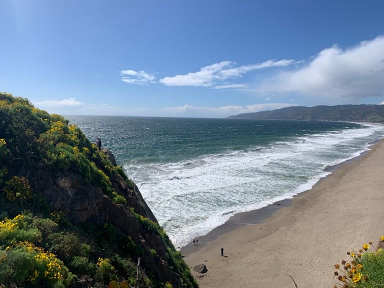


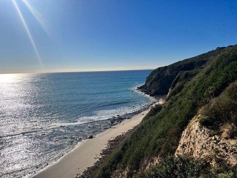
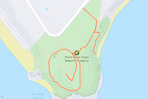
Point Dume Trail
Point Dume is a rocky headland jutting southward into the Pacific Ocean, next to a fine beach and community of the same name. Views from the top of the headland are phenomenal, stretching over sandy beaches and sea cliffs on both sides, as well as over the open Pacific Ocean....
2


M*A*S*H TV Set Hike
Malibu Creek State Park is a large, mountainous open space in between LA and Thousand Oaks. It has many miles of hiking and biking trails, a few swimming holes, good rock climbing, wildflowers, and lots of wildlife, but one of the things it’s most famous for is the outdoor set of the TV show M*A*S*H....
3


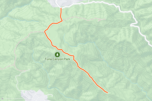
Tuna Canyon Budwood Motorway
For a dose of nature and a breath of fresh air in the hills above the Pacific Coast Highway, make the scenic side trip to Tuna Canyon Park. Its handful of trails roll along ridges that tumble down to the sea along the quiet stretch of coast between Santa Monica and Malibu....
4


Topanga Lookout
The Topanga Lookout Trail is a great option if you are looking for a short and easy hike with stunning views of the Santa Monica Mountains and beyond. This 2-mile round trip hike follows a paved road and a dirt trail to the former site of a fire tower, where you can enjoy panoramic vistas of Calabasas Peak, Red Rock Canyon Park, and the San Fernando Valley....
5


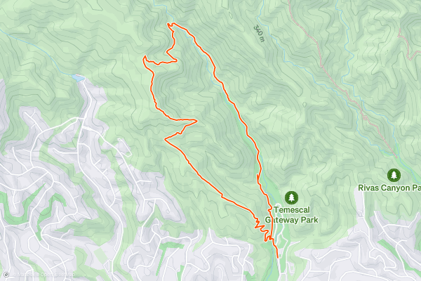
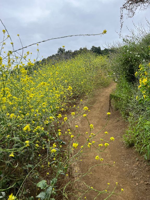
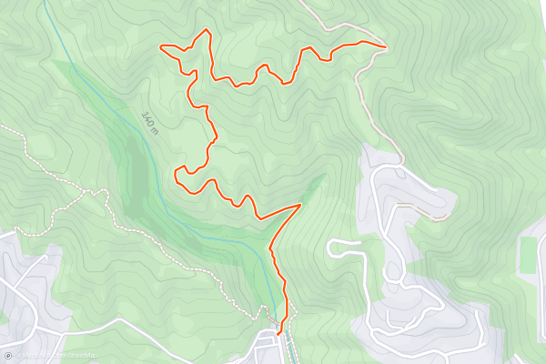
Temescal Canyon Loop
Temescal Canyon is a getaway to nature very near Santa Monica and West Los Angeles. It’s a verdant canyon in the foothills of the Santa Monica Mountains, with a stream that flows for much of the year....
6


Escondido Falls
Escondido is one of the tallest waterfalls near LA, but it only flows seasonally. Come in the days following rainfall to see it at its best. The water streams down a 100-foot rock face that’s draped in greenery, then collects in a small pool and flows on down the canyon....
7


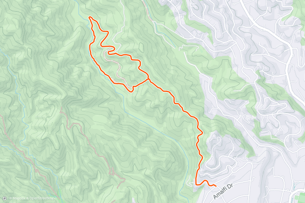
Los Leones Trail.
Offering huge views across Los Angeles, the Pacific Ocean and the peaks of Topanga State Park, this is a superb hike just above Castellammare. One thing to note before saying anything else is that dogs are not allowed on this trail - leave your pooch at home!
There is a designated parking lot for the hike and it's easily reached from the Pacific Coast Highway....
8


Murphy Ranch: Rustic Canyon
Murphy Ranch is a beautiful hike that allows hikers to reach a unique historical site. The hike begins from a neighborhood—not a designated parking lot—but it soon departs the paved roads for a gated dirt road to head down into Rustic Canyon....
9


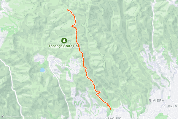
Temescal Ridge to Temescal Peak
Temescal Ridge rises from the Pacific Palisades, near sea level, to the top of Temescal Peak at 2100 feet. The trail and fire road that traverse the ridge make a somewhat strenuous and very scenic hike from the city into the hills....
Le regioni con più sentieri escursionistici su Strava
- Acadia National Park
- Alabama
- Alaska
- Albuquerque
- Alyeska
- Angeles National Forest
- Arizona
- Arkansas
- Austin, TX
- Bay Area
- Bend
- Big Sky
- Blue Mountain Ski Area
- Boston
- Boulder, CO
- Brevard
- Bridger Bowl
- Buena Vista
- California
- Cape Cod
- Colorado
- Connecticut
- Dahlonega
- Downieville
- Ellijay
- Flagstaff
- Florida
- Georgia
- Glacier National Park (USA)
- Grand Teton National Park
- Great Smoky Mountains National Park, TN
- Hawaii
- Hurricane
- Hyalite
- Idaho
- Illinois
- Indiana
- Kansas
- Kentucky
- Lake Tahoe
- Las Vegas, NV
- Los Angeles, CA
- Maine
- Mammoth Mountain
- Marin County
- Maryland
- Massachusetts
- Maui, HI
- Michigan
- Minnesota
- Missouri
- Moab
- Montana
- Mount Rainier National Park
- Mt. Rainier National Park, WA
- Nederland
- Nevada
- New Hampshire
- New Jersey
- New Mexico
- New York
- New York, NY
- North Bridgers
- North Carolina
- North Dakota
- Oakridge
- Ohio
- Oklahoma
- Oregon
- Park City and Deer Valley
- Pennsylvania
- Phoenix, AZ
- Placitas
- Portland, OR
- Roanoke
- Salida
- Salt Lake City, UT
- San Diego, CA
- San Francisco, CA
- Santa Fe, NM
- Santa Monica Mountains
- Seattle, WA
- Sedona, AZ
- Sisters
- South Carolina
- South Dakota
- South Lake Tahoe, CA
- Stowe
- Sugarbush
- Sun Valley
- Taos
- Telluride
- Tennessee
- Texas
- Timberline Lodge Summer
- Utah
- Vermont
- Virginia
- Washington
- West Virginia
- Wind River Range
- Winter Park
- Wisconsin
- Wyoming
- Yellowstone National Park
- Yosemite National Park, CA
- Zion National Park, UT