
As melhores Trilhas de caminhada neste local: Marin County
Explorar Trilhas de caminhada19 principais trilhas de caminhada neste local: Marin County
1


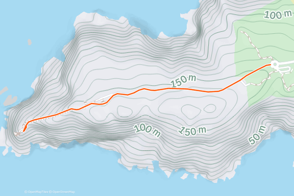
Point Reyes Lighthouse Path
The Point Reyes lighthouse dates back to 1870 when it warned ships of the rocky Point Reyes Headlands. It is today replaced by an automated light, but the National Park Service maintains the old lighthouse as a historic and scenic landmark....
2


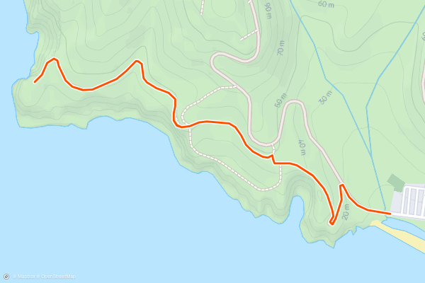
Tennessee Point
Rodeo Beach is a top destination in the Marin Headlands, popular for its uniquely dark-colored sand, surrounding cliffs, and sea stacks rising from the waves. When visiting Rodeo Beach, you can take a short hike to Tennessee Point for even better coastal views....
3


Tennessee Valley Trail
Tennessee Valley is a glen of green among rolling hills, with a stream that trickles with water toward the sea. Where it meets the blue waves is a dark-sand beach cradled by golden cliffs, one of which has a natural window through to the sky....
4


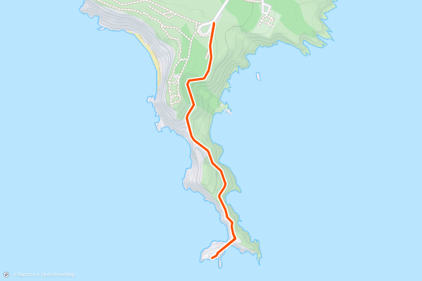
Point Bonita Lighthouse and Battery Wallace
Point Bonita is perhaps the most dramatic spot in all of Marin Headlands. It’s a rocky spine jutting into the mouth of the Bay, tipped with a natural arch of black basalt....
5


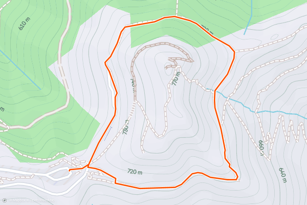
Verna Dunshee Loop
If you are looking for a short and easy hike with stunning views of the Bay Area, the Verna Dunshee hiking trail is a great option. This 0.7-mile loop trail circles around the East Peak of Mount Tamalpais, the highest point in Marin County....
6


Bodega Head Trail
Beginning at the Bodega Head parking area, the Bodega Head Trail winds its way along the rugged coastline of Bodega Bay, providing panoramic views of the Pacific Ocean. The trailhead is easily accessible from Highway 1, and as you set off on the Bodega Head Trail, you'll be immersed in the natural beauty of the Sonoma Coast, with its dramatic cliffs, crashing waves, and abundant wildlife....
7


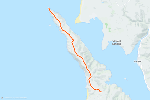
Tomales Point Trail
Tomales Point is the remote, northernmost tip of the large peninsula that is Point Reyes National Seashore. Its windswept hills and wave-battered bluffs receive the brunt of Pacific Ocean force, sheltering the calm Tomales Bay behind it....
8


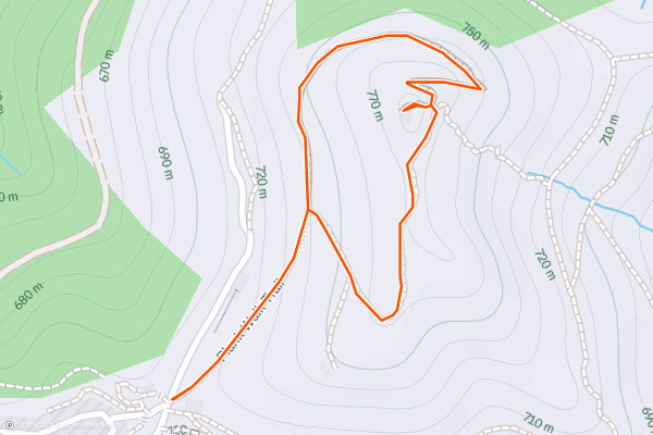
Plank Walk Trail
This short but somewhat steep loop leads from the state park visitor center to the top of Mount Tam’s East Peak. Along the trail you will get great views in all directions around the mountain....
9


Muir Woods Canopy View Loop
Muir Woods National Monument is a small plot of public land that protects some of the oldest and largest trees in the Bay Area. The famous residents are coastal redwoods, which grow to be taller than any other tree on Earth....
10


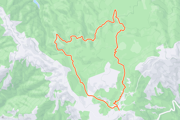
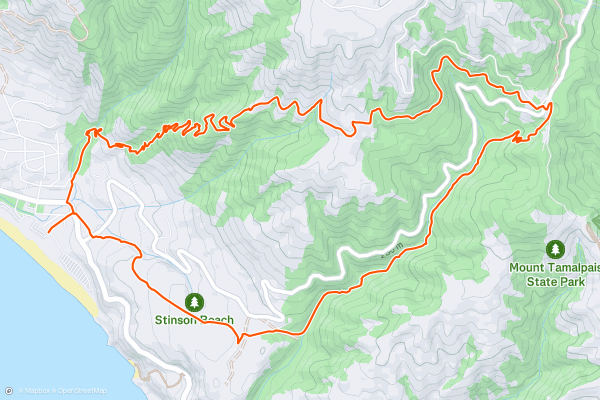
Cataract Falls Loop from Rock Spring
Cataract Creek is a very popular hiking destination near Mount Tamalpais. This loop includes some of the waterfalls on the creek, but also utilizes lesser-traveled trails to explore more of the mountain’s slopes....
11

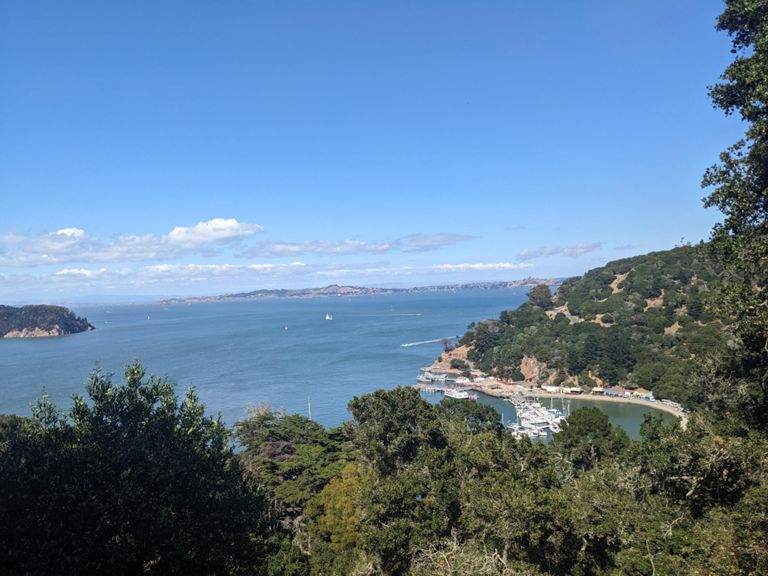


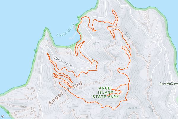
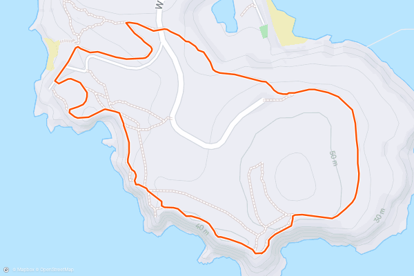
Angel Island Summit Loop
Angel Island is the largest island in the San Francisco Bay. Though it’s not as famous as its much-smaller neighbor Alcatraz, Angel has much more to offer in activities and scenery....
12


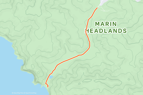
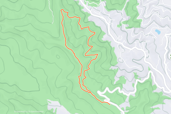
Wolf Ridge and Hill 88 Loop
This is one of the best moderate hikes in Marin Headlands. Clear weather is ideal, so you can see the distant views, but foggy days can be enjoyable, too. Apart from the vistas, it features war bunkers, hillside rock outcrops, spring wildflowers, and a chance at spotting wildlife....
13


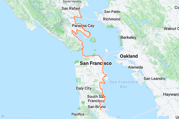
San Francisco Bay Trail
Covering over 1600 square miles, San Francisco Bay ranks as one of America's, and the world's, most recognisable sections of shoreline. From the Golden Gate bridge to the steep streets of San Francisco city and the natural wonders which lie close to both, this is a waterway which every hiker should explore one day....
14


Sonoma Overlook Trail
The Sonoma Overlook Trail is a lovely little hike offering fantastic views of Sonoma Valley and the surrounding countryside. The trail is around 3 miles (round trip) and you'll need a couple of hours to do it....
15


Chimney Rock Trail
Chimney Rock Trail in California offers outdoor enthusiasts a captivating journey through the stunning landscapes of Point Reyes National Seashore. The trail is relatively short, approximately 1.75 miles round trip, and is considered to be a straightforward hike....
16


Dipsea Trail
Dipsea is well-known by trail runners in Marin County, and by many in the greater Bay Area, as the course of an annual race as well as an every-day favorite for fitness....
17


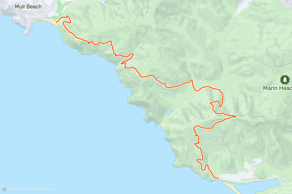
Coastal Trail: Rodeo Beach to Muir Beach
This out and back hike links two of the best beaches in the Marin Headlands, and all of the green rolling hills in between. You’ll enjoy views along the craggy coast, over the boundless ocean, and to Mount Tamalpais—all on a clear day, that is....
18


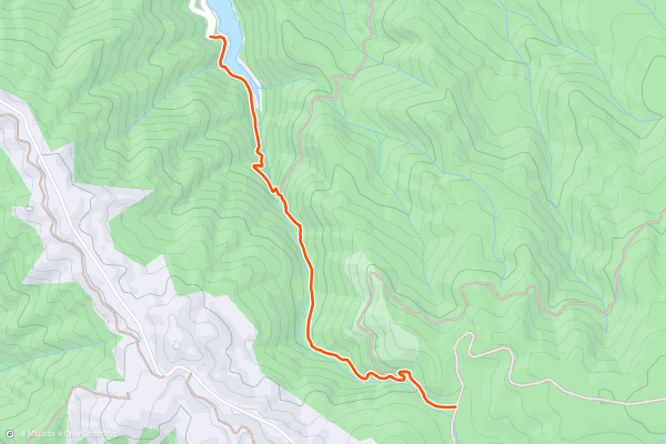
Cataract Falls from Alpine Lake
Cataract Creek, in the Mount Tamalpais Watershed, is one of the loveliest streams around because of its abundance of waterfalls. Countless small cascades, and quite a few bigger ones, tumble through lush, mossy forest on their way down to Alpine Lake....
19


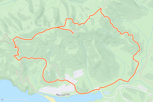
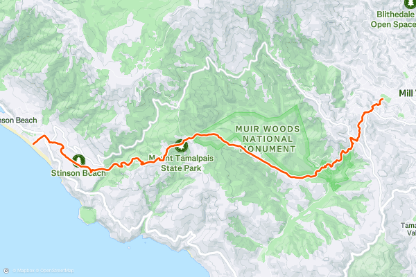
Steep Ravine - Matt Davis Trail Loop
This trail combo packs a lot of Marin County’s best scenery into a relatively compact, moderately challenging loop. There’s a sandy beach, elevated ocean views, mountainside meadows, redwood forests, and (after recent rainfall) lots of little waterfalls....
Principais regiões para trilhas de caminhada no Strava
- Acadia National Park
- Alabama
- Alaska
- Albuquerque
- Alyeska
- Angeles National Forest
- Arizona
- Arkansas
- Austin, TX
- Bay Area
- Bend
- Big Sky
- Blue Mountain Ski Area
- Boston
- Boulder, CO
- Brevard
- Bridger Bowl
- Buena Vista
- California
- Cape Cod
- Colorado
- Connecticut
- Dahlonega
- Downieville
- Ellijay
- Flagstaff
- Florida
- Georgia
- Glacier National Park (USA)
- Grand Teton National Park
- Great Smoky Mountains National Park, TN
- Hawaii
- Hurricane
- Hyalite
- Idaho
- Illinois
- Indiana
- Kansas
- Kentucky
- Lake Tahoe
- Las Vegas, NV
- Los Angeles, CA
- Maine
- Mammoth Mountain
- Marin County
- Maryland
- Massachusetts
- Maui, HI
- Michigan
- Minnesota
- Missouri
- Moab
- Montana
- Mount Rainier National Park
- Mt. Rainier National Park, WA
- Nederland
- Nevada
- New Hampshire
- New Jersey
- New Mexico
- New York
- New York, NY
- North Bridgers
- North Carolina
- North Dakota
- Oakridge
- Ohio
- Oklahoma
- Oregon
- Park City and Deer Valley
- Pennsylvania
- Phoenix, AZ
- Placitas
- Portland, OR
- Roanoke
- Salida
- Salt Lake City, UT
- San Diego, CA
- San Francisco, CA
- Santa Fe, NM
- Santa Monica Mountains
- Seattle, WA
- Sedona, AZ
- Sisters
- South Carolina
- South Dakota
- South Lake Tahoe, CA
- Stowe
- Sugarbush
- Sun Valley
- Taos
- Telluride
- Tennessee
- Texas
- Timberline Lodge Summer
- Utah
- Vermont
- Virginia
- Washington
- West Virginia
- Wind River Range
- Winter Park
- Wisconsin
- Wyoming
- Yellowstone National Park
- Yosemite National Park, CA
- Zion National Park, UT