
Las mejores Rutas de senderismo en Alabama
Explorar Rutas de senderismoLas 5 rutas de senderismo más populares en Alabama
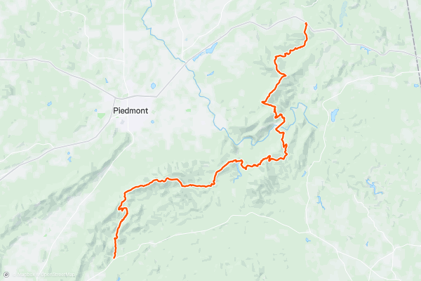
1
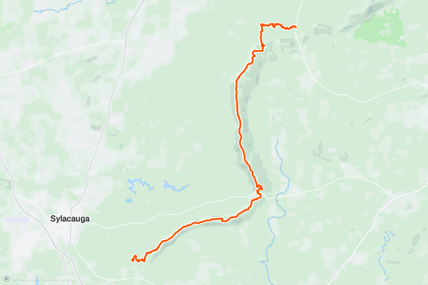
Pinhoti: Trammel Trailhead to Porter's Gap
This segment of the Pinhoti Trail is a backpacker's dream. Just a short drive from Sylacauga, the trail follows two long ridgetops, offering plenty of views along the way. Stage vehicles at either end and hike what many would consider one of the easier portions of the 330-mile long Pinhoti....
2
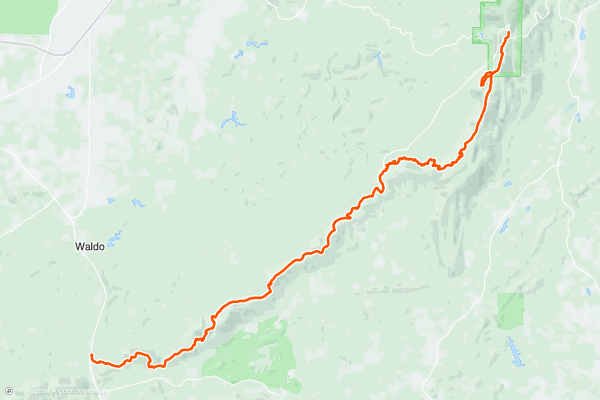
Pinhoti Trail: Cheaha State Park to FS-500
This portion of the Pinhoti Trail begins at Alabama's high point and terminates just a short drive from Interstate 20. Perfect as a shuttled hike, thru-hike, or overnight trip, it showcases the diversity of terrain found in the region....
3
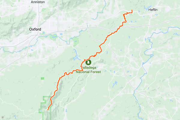
Pinhoti Trail: Porter's Gap to Cheaha State Park
This portion of the Pinhoti Trail begins at the trailhead along Ashland Highway, also referred to as AL-77. An unpaved parking area lies on the east side of the road and is easy to locate....
4
Pinhoti Trail: FS-500 to Burns Trailhead
This segment of the 330-mile-long Pinhoti Trail begins and ends at two popular trailheads, passing through two large campgrounds on its way. Few sweeping views will be found on this portion, but beautiful flora and fauna line this portion of trail as it winds into coves and around points deep in the Piedmont....
5
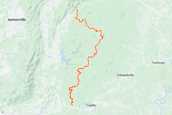
Pinhoti Trail: Burns Trailhead to High Point Trailhead, AL
Beginning at the Burns Trailhead along Rabbittown Road, the Pinhoti skirts around the east side of Red Mountain as it makes its way into Dugger Mountain Wilderness. Alabama's third and newest Wilderness Area, Dugger Mountain Wilderness encompasses over 9,000 acres in Talladega National Forest....
Las regiones más populares para rutas de senderismo en Strava
- Acadia National Park
- Alabama
- Alaska
- Albuquerque
- Alyeska
- Angeles National Forest
- Arizona
- Arkansas
- Austin, TX
- Bay Area
- Bend
- Big Sky
- Blue Mountain Ski Area
- Boston
- Boulder, CO
- Brevard
- Bridger Bowl
- Buena Vista
- California
- Cape Cod
- Colorado
- Connecticut
- Dahlonega
- Downieville
- Ellijay
- Flagstaff
- Florida
- Georgia
- Glacier National Park (USA)
- Grand Teton National Park
- Great Smoky Mountains National Park, TN
- Hawaii
- Hurricane
- Hyalite
- Idaho
- Illinois
- Indiana
- Kansas
- Kentucky
- Lake Tahoe
- Las Vegas, NV
- Los Angeles, CA
- Maine
- Mammoth Mountain
- Marin County
- Maryland
- Massachusetts
- Maui, HI
- Michigan
- Minnesota
- Missouri
- Moab
- Montana
- Mount Rainier National Park
- Mt. Rainier National Park, WA
- Nederland
- Nevada
- New Hampshire
- New Jersey
- New Mexico
- New York
- New York, NY
- North Bridgers
- North Carolina
- North Dakota
- Oakridge
- Ohio
- Oklahoma
- Oregon
- Park City and Deer Valley
- Pennsylvania
- Phoenix, AZ
- Placitas
- Portland, OR
- Roanoke
- Salida
- Salt Lake City, UT
- San Diego, CA
- San Francisco, CA
- Santa Fe, NM
- Santa Monica Mountains
- Seattle, WA
- Sedona, AZ
- Sisters
- South Carolina
- South Dakota
- South Lake Tahoe, CA
- Stowe
- Sugarbush
- Sun Valley
- Taos
- Telluride
- Tennessee
- Texas
- Timberline Lodge Summer
- Utah
- Vermont
- Virginia
- Washington
- West Virginia
- Wind River Range
- Winter Park
- Wisconsin
- Wyoming
- Yellowstone National Park
- Yosemite National Park, CA
- Zion National Park, UT