


+ 85
Tolmie Peak
Wander-Trail
Schwer
6,3 mi
1.708 ft
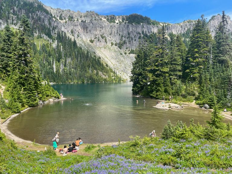
Hike past a sapphire blue lake to 360-degree views of Mount Rainier and the Cascade Range.
The 6.3-mile round-trip hike to Tolmie Peak Lookout packs a “one-two punch when it comes to scenery,” according to Anna Roth of []( thanks to passing by the stunning sapphire blue waters of Eunice Lake on the way to the jaw-dropping vistas from the peak itself. Throughout the entire hike, you’ll be confronted by stunning views of Mount Rainier, with the Cascades spreading out in all directions around you.
While the views from this hike are world-class, the difficulty required to access them is not. While you will have to drive 17 miles down a winding dirt road to reach the trailhead, the actual hike from Mowich Lake to Tolmie Peak is quite moderate. The elevation gain throughout most of the hike is very gradual.
Once you pass Eunice Lake and head toward Ipsut Pass, the grade steepens considerably. If you are beginning to tire by the time you reach Eunice Lake, it’s probably best to turn around at that point and retrace your steps to Mowich Lake.
While there is a campground at Mowich Lake, note that the area near Tolmie Peak is closed to overnight camping, and is thus only accessible via day hike.
Sources:
Written by Greg Heil
Erstellt von
Strava Routes

Route und Höhe
Segmente
| Name | Distanz | Höhenunterschied | Steigung |
|---|---|---|---|
| Mountain Meadows Rd Climb | 0,50 mi | 499 ft | 18,7 % |
| Tolmie Peak Trail Climb | 0,78 mi | 574 ft | 13,9 % |
| Tolmie Peak Trail Climb | 0,23 mi | 223 ft | 17,8 % |