

+ 2
Caprock Coulee Nature Trail
Тропа для хайкинга
Низкая сложность
4,03 ми
663 фт
A versatile hike showcasing the beauty of North Dakota's iconic badlands.
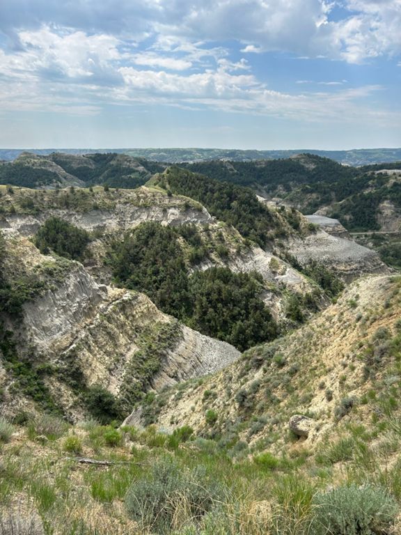
The Caprock Coulee Trail in Theodore Roosevelt NP's Northern Unit is a classic day hike exploring several unique ecosystems and geological features that make up the badlands. A brochure is available to accompany your hike, and the trek can be as short as 1.6 miles round-trip if you're running short on time. Seen here, though, this 4-mile circuit a great option for everyone in the family, and it "provides a rare look at a densely wooded area of the park," the NPS notes. Coulees are defined as steep and narrow valleys formed by water, though they are typically dry during the summer, the park notes. French fur trappers in the 1800's first coined the tern "coulée," which means "flow" in French, and the unique patterns formed along the hillsides are a type of erosion caused by rain and snowmelt. Rivulet erosion, as referenced in the trail guide, "is one of the many never-ending systems of erosion taking place in the badlands. With each rain shower, the land changes shape." There are two trailheads to enjoy this hike, the River Bend Overlook to the west (seen here) and another trailhead just to the east on Scenic Loop Dr. If you're seeking a shorter out-and-back, consider the eastern trailhead instead. Neither water nor restrooms are available at either, though you will pass the visitor center when you enter the park. [Click here]( to view the complete trail guide courtesy of the NPS. [NPS]( Written by Brendon Voelker
The Caprock Coulee Trail in Theodore Roosevelt NP's Northern Unit is a classic day hike exploring several unique ecosystems and geological features that make up the badlands. A brochure is available to accompany your hike, and the trek can be as short as 1.6 miles round-trip if you're running short on time. Seen here, though, this 4-mile circuit a great option for everyone in the family, and it "provides a rare look at a densely wooded area of the park," the NPS notes. Coulees are defined as steep and narrow valleys formed by water, though they are typically dry during the summer, the park notes. French fur trappers in the 1800's first coined the tern "coulée," which means "flow" in French, and the unique patterns formed along the hillsides are a type of erosion caused by rain and snowmelt. Rivulet erosion, as referenced in the trail guide, "is one of the many never-ending systems of erosion taking place in the badlands. With each rain shower, the land changes shape." There are two trailheads to enjoy this hike, the River Bend Overlook to the west (seen here) and another trailhead just to the east on Scenic Loop Dr. If you're seeking a shorter out-and-back, consider the eastern trailhead instead. Neither water nor restrooms are available at either, though you will pass the visitor center when you enter the park. [Click here]( to view the complete trail guide courtesy of the NPS. [NPS]( Written by Brendon Voelker
