

+ 50
Clingmans Dome
Trilha de caminhada
Alto
1,23 mi
367 pés
Paved path to an observation tower at the highest point in Great Smoky Mountains National Park.
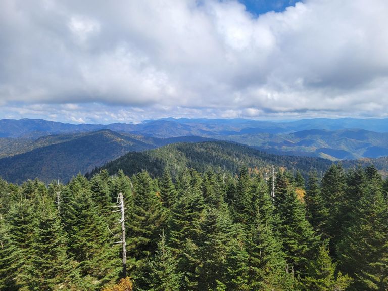
Clingmans Dome is the highest point in Great Smoky Mountains National Park and the third tallest mountain east of the Mississippi. It’s summit is 6,643 feet above sea level, but not hard to reach thanks to a road and paved trail that leads to an observation tower If you want an epic view without epic effort to reach it, Clingmans Dome is for you.
It still takes a little work, though. The half-mile path is somewhat steep and exposed to the elements. In summer it’s usually hot, but at other times of year it can be surprisingly cold and windy at this elevation. If you’re used to sea level, you might even feel shortness of breath here at well over 6,000 feet. Informative signs and lofty views make good excuses to pause and rest. The surroundings are deep glades of spruce-fir forest, unique to these high mountains in the Southeast.
A final climb up the tower’s spiral ramp reveals the real treat—360 degrees of unrivaled vantage over the Smoky Mountains. On a clear day you can see 100 miles, but unfortunately the air is usually less than crystal. Winter days are the clearest, but the road is closed December to March for snow. During that time, you can reach the summit by hiking or skiing either the road or the Appalachian Trail from Newfound Gap, a more serious endeavor than the normal approach.
Sources:
Written by Jesse Weber
Rota e elevação
Segmentos
| Nome | Distância | Dif. de elev. | Inclinação média |
|---|---|---|---|
| Appalachian Trail Climb | 0,67 mi | 338 pés | 9,4% |
