

+ 62
Bruce Freeman Rail Trail
Hiking Trail
Moderate
15.09 mi
263 ft
A beautiful rails-to-trails route beginning in Lowell.
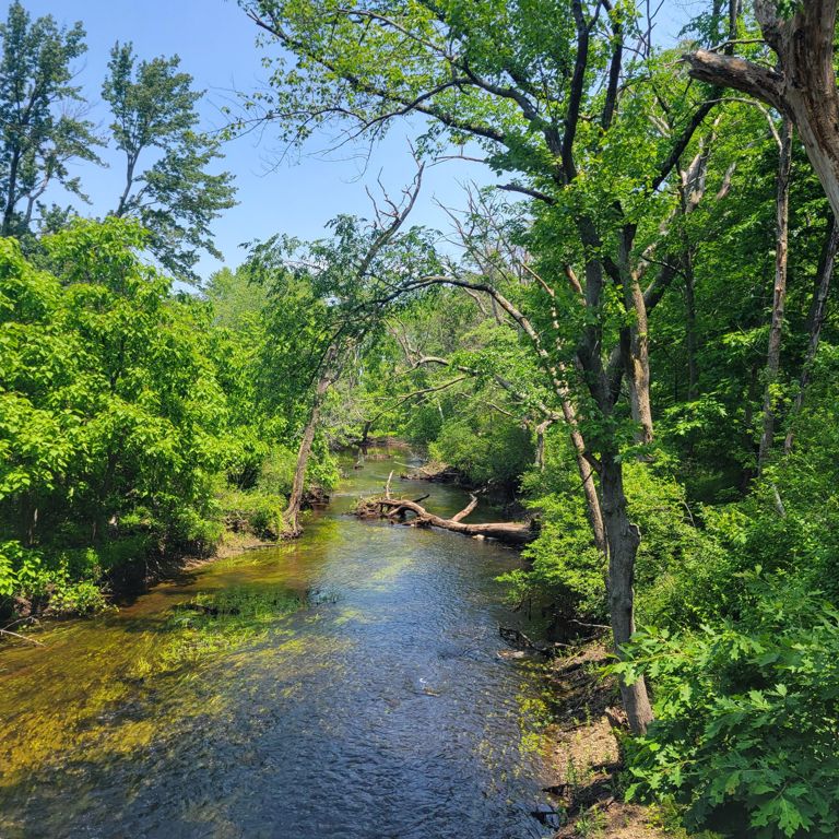
Following the 25-mile route of the old New Haven Railroad Framingham & Lowell line, the Bruce Freeman Rail Trail is a scenic and historic rail trail that spans eight communities in Massachusetts: Lowell, Chelmsford, Westford, Carlisle, Acton, Concord, Sudbury, and Framingham. Whether you are looking for urban landscapes and historic sites or rural farmlands and natural areas, you will find something to enjoy on this trail. You can use the trail for cycling, jogging, walking, rollerblading, skiing, and other non-motorized activities. The trail has a 10-foot wide pavement with a 2-foot wide packed shoulder on each side. It is mostly flat and easy to navigate, with some gentle slopes and curves. Along the trail, you will find parking areas, restrooms, benches, and water fountains. A popular section of the trail is the one that runs from Lowell to White Pond Reservation in Concord. It covers about 15 miles and goes through four towns: Lowell, Chelmsford, Westford, and Acton. Near Cross Point and Rt. 3 in Lowell, you can park your car and access other trails. In Chelmsford Center, you can shop, eat, and visit the Chelmsford Center for the Arts. As you continue through Westford and Carlisle, you can admire the views of open fields and wetlands. In Acton, you can find more amenities at NARA Park, Goulds’ Plaza, Patriot Square, and Ice House Pond. At White Pond Reservation in Concord, the trail ends. This is a beautiful natural area with a pond, beach, picnic area, and trails. You can also connect to the Minuteman Bikeway and the Reformatory Branch Trail from here. After a long ride or walk on the Bruce Freeman Rail Trail, this is a great place to relax and enjoy nature. Sources: Visit the Trail | Bruce Freeman Rail Trail | Massachusetts. Visit Phase 1 & Phase 2A | Bruce Freeman Rail Trail | Massachusetts. Conversation with Bing Chat Written by FATMAP Official
Following the 25-mile route of the old New Haven Railroad Framingham & Lowell line, the Bruce Freeman Rail Trail is a scenic and historic rail trail that spans eight communities in Massachusetts: Lowell, Chelmsford, Westford, Carlisle, Acton, Concord, Sudbury, and Framingham. Whether you are looking for urban landscapes and historic sites or rural farmlands and natural areas, you will find something to enjoy on this trail. You can use the trail for cycling, jogging, walking, rollerblading, skiing, and other non-motorized activities. The trail has a 10-foot wide pavement with a 2-foot wide packed shoulder on each side. It is mostly flat and easy to navigate, with some gentle slopes and curves. Along the trail, you will find parking areas, restrooms, benches, and water fountains. A popular section of the trail is the one that runs from Lowell to White Pond Reservation in Concord. It covers about 15 miles and goes through four towns: Lowell, Chelmsford, Westford, and Acton. Near Cross Point and Rt. 3 in Lowell, you can park your car and access other trails. In Chelmsford Center, you can shop, eat, and visit the Chelmsford Center for the Arts. As you continue through Westford and Carlisle, you can admire the views of open fields and wetlands. In Acton, you can find more amenities at NARA Park, Goulds’ Plaza, Patriot Square, and Ice House Pond. At White Pond Reservation in Concord, the trail ends. This is a beautiful natural area with a pond, beach, picnic area, and trails. You can also connect to the Minuteman Bikeway and the Reformatory Branch Trail from here. After a long ride or walk on the Bruce Freeman Rail Trail, this is a great place to relax and enjoy nature. Sources: Visit the Trail | Bruce Freeman Rail Trail | Massachusetts. Visit Phase 1 & Phase 2A | Bruce Freeman Rail Trail | Massachusetts. Conversation with Bing Chat Written by FATMAP Official
