


+ 83
Mount Elden Lookout Trail
Ruta de senderismo
Difícil
5.14 mi
2,394 ft
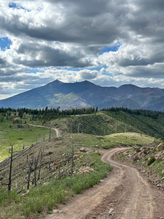
A classic hike in Flagstaff with breathtaking views and incredibly diverse plant life.
Towering 2,300 feet above Flagstaff, Mount Elden is one of the classic day hikes near town to enjoy epic mountaintop views. What starts as an easy stroll from the trailhead quickly transitions into rocky, steep slopes and countless switchbacks that lead to the 9,300-foot summit. While technical, the path is well-traveled, easy to follow, and includes elaborate rockwork such as stairs through the steeper sections. It's described by some as a great opportunity to prepare for a trip to the Grand Canyon, and from the peak, you'll have views of Flagstaff, Oak Creek Canyon, and Mingus Mountain, as well views of the Mogollon Rim to the east.
Based on the source, this hike includes everything from juniper, ponderosa, and pinyon pine at the lower elevations, to mixed conifers as you reach the higher elevations. According to the [Forest Service]( "you may be surprised to encounter a couple of different kinds of cactus in this high, cold environment where they seem to do very well." A series of transmission towers also sit atop the peak, though the former lookout tower is now closed to the public.
According to [this source]( the peak was named after John Elden, "an early settler who arrived in the area in 1875," just prior to the founding of Flagstaff. "In 1887, his son was shot and killed, apparently as part of a dispute over the use of water at a nearby spring," of which Elden Spring was named in his honor. His son's gravesite is not far from the spring, though the family ultimately relocated to California following the incident.
Best enjoyed as a summer morning hike to avoid afternoon storms, this hike begins at a trailhead off of Highway 89 across from the mall and next to the Ranger Station. There are no restrooms or drinking water, though there are plenty of opportunities nearby to get either.
Sources:
Written by Brendon Voelker
Creada por
Strava Routes

Ruta y desnivel
Segmentos
| Nombre | Distancia | Diferencia de altitud | Pendiente media |
|---|---|---|---|
| Elden LO Trail up to Sunset | 2.64 mi | 2,201 ft | 15.6 % |
| Elden Lookout Rd Climb | 2.94 mi | 2,408 ft | 15.5 % |
| 1st half clockwise to Eldon split, Fat man's loop | 0.98 mi | 568 ft | 10.9 % |
| Elden to the TOP, aka - Take your dog poop with you | 2.24 mi | 2,211 ft | 18.7 % |
| Mt Elden LO Climb | 2.33 mi | 2,044 ft | 16.6 % |
| Elden LO from FoN to top | 2.45 mi | 2,116 ft | 16.3 % |
| Mt. Elden UH from Fat Man to Sunset | 1.39 mi | 1,614 ft | 21.8 % |
| Mt Elden LO Descent | 2.30 mi | -2,057 ft | -16.9 % |
| Elden LO from top to FoN | 2.51 mi | -2,113 ft | -15.9 % |
| Elden LO Trail down from Sunset | 2.63 mi | -2,201 ft | -15.8 % |
| Fat Man's Loop CCW DH | 0.66 mi | -499 ft | -14.3 % |