


+ 95
Bluff Knoll
Hiking Trail
Hard
3.94 mi
2,305 ft
In the heart of the Stirling Range National Park, Bluff Knoll is a popular hike which boasts some spectacular views of the surrounding area.
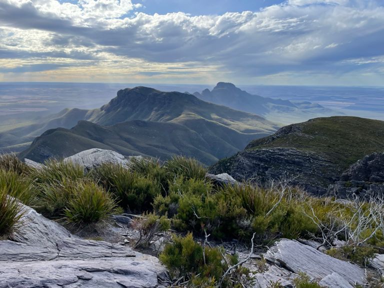
Bluff Knoll is the highest peak in the Stirling Range, and one of the highest peaks in Western Australia, standing at 1,095 meters (3,590 feet) above sea level. The hike to the summit of Bluff Knoll is a popular one for visitors to the Stirling Range national park, and offers beautiful views of the surrounding landscape.
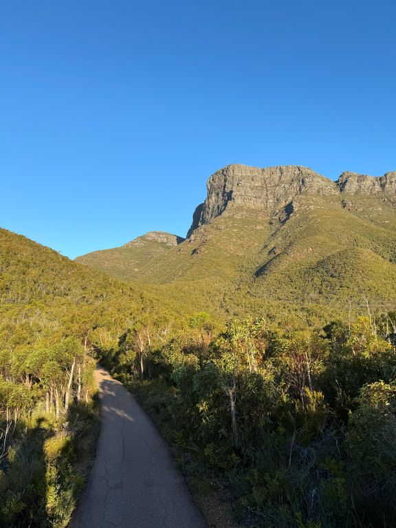
To reach the summit, hikers follow a well-marked trail that begins at the Bluff Knoll car park. The 6.4km / 3.9 mile out-and-back hike takes from 3-4 hours to complete. It is a moderately difficult hike, with some steep and rocky sections. Hikers should be in good physical condition and bring plenty of water, snacks, and sun protection, as the weather in the Stirling Range can be quite hot and dry.
Along the way, hikers will pass through a variety of different landscapes, including eucalyptus forests, heathlands, and rocky outcrops. The trail also passes through several distinct vegetation zones, including the Montane Heath zone, which is home to a variety of rare and endangered plant species.
At the summit, hikers are rewarded with stunning views of the surrounding landscape, including the Stirling Range and the Great Southern region of Western Australia. The summit is also home to a small hut, which provides a welcome respite for hikers who need to take a break.
Overall, the Bluff Knoll hike is a challenging but rewarding experience that offers a chance to explore the natural beauty of the Stirling Range National Park. Written by Paul Moore
Bluff Knoll is the highest peak in the Stirling Range, and one of the highest peaks in Western Australia, standing at 1,095 meters (3,590 feet) above sea level. The hike to the summit of Bluff Knoll is a popular one for visitors to the Stirling Range national park, and offers beautiful views of the surrounding landscape.
To reach the summit, hikers follow a well-marked trail that begins at the Bluff Knoll car park. The 6.4km / 3.9 mile out-and-back hike takes from 3-4 hours to complete. It is a moderately difficult hike, with some steep and rocky sections. Hikers should be in good physical condition and bring plenty of water, snacks, and sun protection, as the weather in the Stirling Range can be quite hot and dry.
Along the way, hikers will pass through a variety of different landscapes, including eucalyptus forests, heathlands, and rocky outcrops. The trail also passes through several distinct vegetation zones, including the Montane Heath zone, which is home to a variety of rare and endangered plant species.
At the summit, hikers are rewarded with stunning views of the surrounding landscape, including the Stirling Range and the Great Southern region of Western Australia. The summit is also home to a small hut, which provides a welcome respite for hikers who need to take a break.
Overall, the Bluff Knoll hike is a challenging but rewarding experience that offers a chance to explore the natural beauty of the Stirling Range National Park. Written by Paul Moore
Route and Elevation
Segments
| Name | Distance | Elev. Diff. | Avg. Grade |
|---|---|---|---|
| Bluff Knoll Rd Climb | 0.59 mi | 768 ft | 24.5% |
| Bluff Knoll Rd Climb | 1.31 mi | 1,365 ft | 19.6% |
| Bluff Knoll Sprint | 1.72 mi | -1,890 ft | -20.1% |