

Baker Lake
远足路径
比较难
3.29英里
846英尺
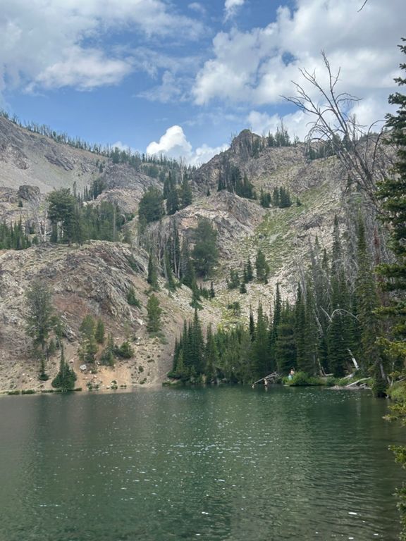
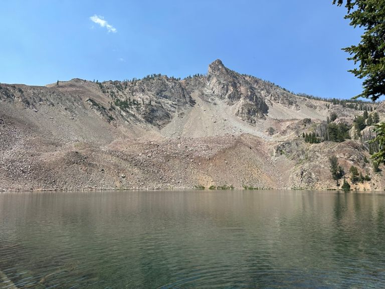
A clear blue lake high in the mountains, perfect for cooling off in the heat of summer.
If you want to see an alpine lake tucked beneath pointy peaks and patches of snow that linger into summer, but don’t feel up for a strenuous hike into the mountains, Baker Lake is the place you should go. It’s the quintessential alpine lake, but easier to reach than you might imagine. A good dirt road leads to the trailhead, and from there it’s a moderately uphill hike to the edge of the lake, suitable for all ages and popular with families. The trail leads through an interesting patchwork of vegetation, which is the natural result of fire on the landscape. Many trees are dead but still standing, while others have fallen. Plenty of trees survived the fire, too, and still grow as healthy as ever. Much of the hillsides are open meadows, which burst with wildflowers in early summer. Because most of the trail is exposed to the sun, it gets quite hot in summer. The good news is that cold water is not far away. Once at the lake you can dip your feet, or get all the way in and go for a swim. It’s also stocked with trout, so fishing can be a way to spend part of the day. If you do feel like hiking farther, the uncrowded Baker Creek-Norton Creek Trail connects to this one, and makes a stout climb to a ridgeline above, granting excellent views over more of the mountains. Sources: Written by Jesse Weber
If you want to see an alpine lake tucked beneath pointy peaks and patches of snow that linger into summer, but don’t feel up for a strenuous hike into the mountains, Baker Lake is the place you should go. It’s the quintessential alpine lake, but easier to reach than you might imagine. A good dirt road leads to the trailhead, and from there it’s a moderately uphill hike to the edge of the lake, suitable for all ages and popular with families. The trail leads through an interesting patchwork of vegetation, which is the natural result of fire on the landscape. Many trees are dead but still standing, while others have fallen. Plenty of trees survived the fire, too, and still grow as healthy as ever. Much of the hillsides are open meadows, which burst with wildflowers in early summer. Because most of the trail is exposed to the sun, it gets quite hot in summer. The good news is that cold water is not far away. Once at the lake you can dip your feet, or get all the way in and go for a swim. It’s also stocked with trout, so fishing can be a way to spend part of the day. If you do feel like hiking farther, the uncrowded Baker Creek-Norton Creek Trail connects to this one, and makes a stout climb to a ridgeline above, granting excellent views over more of the mountains. Sources: Written by Jesse Weber
