

+ 36
Humboldt Peak
Ruta de senderismo
Dura
12,33 mi
4.345 ft
One of the least technical peaks in the Sangres.
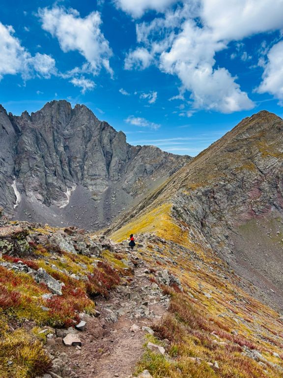
The 14,000-foot peaks in the Sangre de Cristo Range are renowned for some of the most technical 14er climbing in the state of Colorado. In contrast to the more technical routes, Humboldt Peak only demands a Class 2 climb to access its 14,064-foot summit. Consequently, "Humboldt Peak serves as the 'introduction to the Sangre de Cristo' mountains for many a peak hunter,” according to Kiefer and Sarah Simon on []( They claim that the standard route is a perfect introduction to 14er hiking. While it might not be technical, the standard route, mapped here, requires 12 and a half miles of hiking and over 4,300 feet of elevation gain (and descent). To help you enjoy this gorgeous terrain, ensure that you’ve trained adequately for this big day out in the mountains! The approach trail climbs up a mellow valley before reaching the bottom of the basin. From the basin, turn right and begin climbing in earnest to reach the ridgeline. Once on the ridge, keep turning right and follow the ridge past a false summit to the summit of Humboldt. While you’ll have to conquer some scree fields and rock blocks on this hike, overall this is a delightfully non-technical mountain climb! Sources: Written by Greg Heil
The 14,000-foot peaks in the Sangre de Cristo Range are renowned for some of the most technical 14er climbing in the state of Colorado. In contrast to the more technical routes, Humboldt Peak only demands a Class 2 climb to access its 14,064-foot summit. Consequently, "Humboldt Peak serves as the 'introduction to the Sangre de Cristo' mountains for many a peak hunter,” according to Kiefer and Sarah Simon on []( They claim that the standard route is a perfect introduction to 14er hiking. While it might not be technical, the standard route, mapped here, requires 12 and a half miles of hiking and over 4,300 feet of elevation gain (and descent). To help you enjoy this gorgeous terrain, ensure that you’ve trained adequately for this big day out in the mountains! The approach trail climbs up a mellow valley before reaching the bottom of the basin. From the basin, turn right and begin climbing in earnest to reach the ridgeline. Once on the ridge, keep turning right and follow the ridge past a false summit to the summit of Humboldt. While you’ll have to conquer some scree fields and rock blocks on this hike, overall this is a delightfully non-technical mountain climb! Sources: Written by Greg Heil
Ruta y desnivel
Segmentos
| Nombre | Distancia | Diferencia de desnivel | Pendiente media |
|---|---|---|---|
| S Colony Rd Climb | 1,43 mi | 830 ft | 11,0 % |
| SCL road to Humboldt split from 4WD TH (ascent) | 2,44 mi | 1.125 ft | 8,7 % |
| South Colony Road Climb | 0,71 mi | 315 ft | 8,3 % |
| South Colony Road to Lakes | 1,23 mi | 869 ft | 13,3 % |
| S Colony Rd Climb | 2,19 mi | 2.411 ft | 20,8 % |
| South Colony Lakes to Humbolt Peak | 1,90 mi | 2.303 ft | 22,9 % |
| Saddle to peak | 0,75 mi | 1.132 ft | 28,4 % |
| Old trailhead to 4wd parking lot | 2,67 mi | -1198 ft | -8,3 % |
| Humboldt spur fork to 4WD TH (descent) | 2,54 mi | -1115 ft | -8,3 % |
