


+ 20
Camelback Mountain via Echo Canyon Trail
Hiking Trail
Hard
3.52 km
392 m
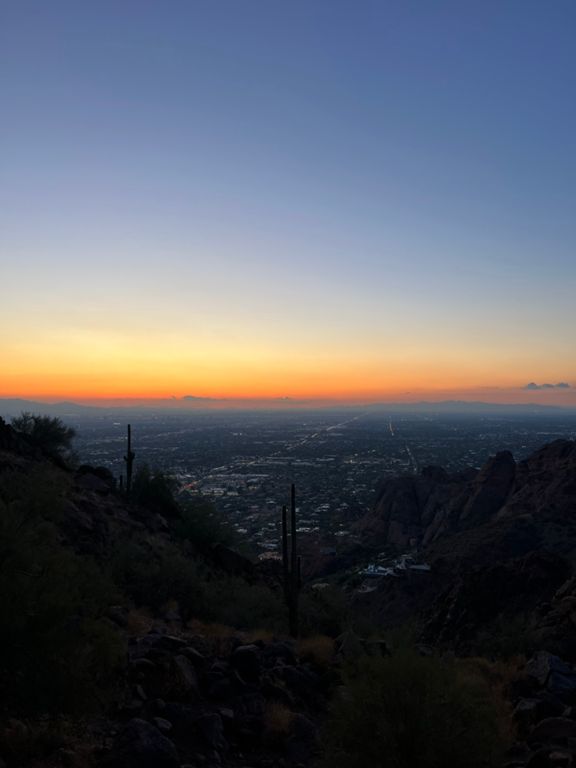
The more adventurous of two trails leading to the best view over Phoenix and Scottsdale
Camelback Mountain is one of the most prominent peaks near Phoenix and Scottsdale, visible from almost anywhere and begging to be climbed. Once on top, it’s like standing on a rocky island in an urban sea, with the cities of the Valley sprawling on all sides. The view is well guarded by a difficult hike, however. The trail is steep and rocky, surrounded by prickly plants, and it bakes in the desert heat, but commanding views and proximity to the city make it a popular and rewarding hike nonetheless. Echo Canyon Trail is the more exciting but more difficult of two routes up Camelback Mountain, the other being the slightly longer and less-steep Cholla Trail.
The climbing begins almost right away as Echo Canyon Trail cuts beneath an overhanging cliff face of the mountain. This section can be slow going because it is steep and narrow. The trail threads between vertical rock on one side and a fence on the other that protects desert vegetation. A staircase of railroad ties is followed by a more natural but even steeper ramp of sandy rock. You may have to use your hands on the rock section, but a sturdy handrail is in place to help. Above there, the ascent continues a bit less steeply but remains just as rocky. In one place there is another handrail but in others you have only the stones to use for holds. Proceed carefully and take breaks often, because heat and fatigue can cause slips and injuries, and watch closely for trail markers because the path can be tricky to follow near the top.
Time this hike during cooler temperatures and come prepared for quite the workout. Early mornings or winter days are the best times, but the trail is open year round. Parking at the trailhead is limited, and often fills up on winter afternoons and weekends. Consider riding your bike or using public transport to get there. Note that dogs are not allowed on Camelback Mountain.
Sources:
Written by Jesse Weber
Route and Elevation
Segments
| Name | Distance | Elev. Diff. | Avg. Grade |
|---|---|---|---|
| Fountain To Top | 2.02 km | 375 m | 18.3% |
| Camelback - Echo side | 3.47 km | -376 m | -0.0% |
| Echo canyon, Start to top of the Second Railing | 0.95 km | 227 m | 15.4% |
| E San Juan Ave Climb | 0.72 km | 218 m | 30.0% |
| NEW '14 Echo Canyon, Camleback Mtn | 2.12 km | 317 m | 19.7% |
| The Approach | 0.51 km | 80 m | 15.6% |
| N 58th Pl Climb | 1.04 km | 236 m | 22.5% |
| Camelback Down | 1.73 km | -382 m | -21.8% |
| Finale Finito | 0.50 km | -75 m | -15.0% |