


+ 87
Annette Lake
Hiking Trail
Hard
7.38 mi
2,008 ft
A spectacular alpine lake high above Snoqualmie Pass.
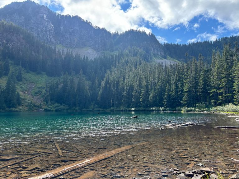
If you are looking for a beautiful hike that offers waterfalls, wildflowers, forests, mountain views and a serene alpine lake, look no further than the Annette Lake Trail. This 7.1-mile out-and-back trail near Snoqualmie Pass will take you through a variety of scenery and terrain, with a gentle but steady elevation gain of 2,290 feet. The trail starts near the Asahel Curtis Nature Trail, where you can admire the mossy trees and giant skunk cabbage along Humpback Creek. After crossing a bridge over one of the best tumbling falls in Washington, the trail enters an open area under powerlines and crosses the Iron Horse Trail. From here, the trail begins to climb through the forest, with occasional small water crossings and wildflower meadows. The trail opens up as you traverse several talus slopes, offering views of Granite Mountain and Humpback Mountain. These are also good places to see trillium and glacier lilies in late spring. After the last talus slope, the trail flattens out and reaches the north shore of Annette Lake. Here you can enjoy the sights of Abiel Peak and Silver Peak, as well as a waterfall cascading into the lake's east shore. There are several campsites around the lake if you want to stay overnight and catch a sunrise or sunset on the water. Sources: Annette Lake — Washington Trails Association. Annette Lake: moderate summer day hike near Seattle. Conversation with Bing Chat Written by FATMAP Official
If you are looking for a beautiful hike that offers waterfalls, wildflowers, forests, mountain views and a serene alpine lake, look no further than the Annette Lake Trail. This 7.1-mile out-and-back trail near Snoqualmie Pass will take you through a variety of scenery and terrain, with a gentle but steady elevation gain of 2,290 feet. The trail starts near the Asahel Curtis Nature Trail, where you can admire the mossy trees and giant skunk cabbage along Humpback Creek. After crossing a bridge over one of the best tumbling falls in Washington, the trail enters an open area under powerlines and crosses the Iron Horse Trail. From here, the trail begins to climb through the forest, with occasional small water crossings and wildflower meadows. The trail opens up as you traverse several talus slopes, offering views of Granite Mountain and Humpback Mountain. These are also good places to see trillium and glacier lilies in late spring. After the last talus slope, the trail flattens out and reaches the north shore of Annette Lake. Here you can enjoy the sights of Abiel Peak and Silver Peak, as well as a waterfall cascading into the lake's east shore. There are several campsites around the lake if you want to stay overnight and catch a sunrise or sunset on the water. Sources: Annette Lake — Washington Trails Association. Annette Lake: moderate summer day hike near Seattle. Conversation with Bing Chat Written by FATMAP Official
Created By
Strava Routes

Route and Elevation
Segments
| Name | Distance | Elev. Diff. | Avg. Grade |
|---|---|---|---|
| John Wayne Pioneer Trail Climb | 2.38 mi | 1,529 ft | 12.1% |
| Milwaukee Road (Railroad Grade) Climb | 0.58 mi | 367 ft | 11.8% |
| Annette Lake up from Trailhead | 3.64 mi | 1,729 ft | 8.8% |
| Pacific Crest Trail Climb | 0.59 mi | 367 ft | 11.5% |
| John Wayne Pioneer Trail Climb | 0.35 mi | 253 ft | 13.6% |
| Pacific Crest Trail Climb | 0.20 mi | 135 ft | 12.3% |
| Annette Lake down to Trailhead | 3.31 mi | -1,732 ft | -9.7% |
| Pacific Crest Trail Climb | 0.23 mi | 138 ft | 11.0% |